One of the major projects we have undertaken with our national parcel file has been to categorize parcels by land use. A simple classification has been used for the first version which is useful for base maps and trade area reports. Mapping land use is complex – many parcels don’t neatly fit into one category or another. An airport terminal is both a transportation land use and retail – and it could be military property used as a dual-use airport. Our land use classification therefore attempts to tag a parcel with the dominant lands use except in one case – our ‘mixed’ land use covers those buildings with significant mixes of commercial, office, and residential space.
A map of land use in Thousand Oaks, California appears below:
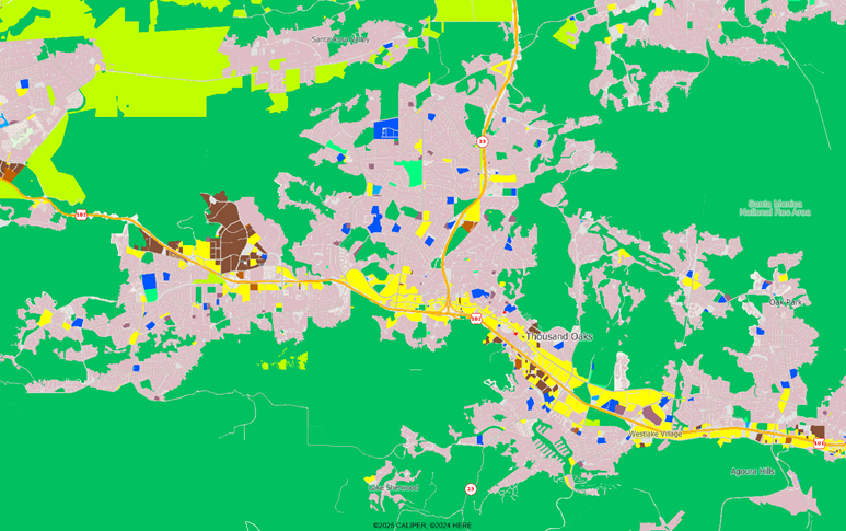
Most of the area land use is either green (natural, agricultural, and parks) or pink (residential). Commercial land use is in yellow, educational in blue, and industrial in brown. Overall, the map is a relatively simple one to interpret, especially for trade area analysis.
If land use reflects actual usage, zoning reflects the usage desired by local government. But what the city wants may not be what they have.
Zoning ordinances were first enacted to minimize conflicts between land uses, such as locating a smelly tannery in the middle of an existing residential area. Over time, these ordinances became increasingly complex through refinement – such as multiple residential zoning areas – and through the granting of exceptions. A map at the same scale shows the major zoning designations used by the city of Thousand Oaks but note that there are areas which are not zoned by the city but instead by the county, as they are not part of the municipal corporate boundaries – users are always reminded that municipal boundaries can be horrendously complex.
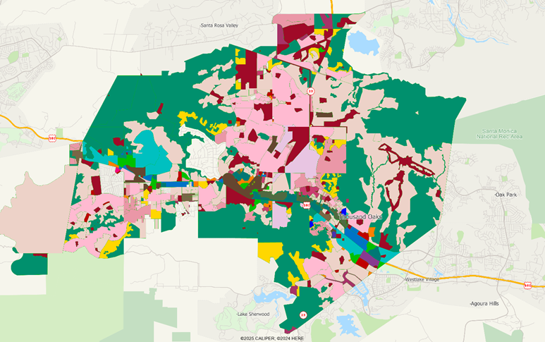
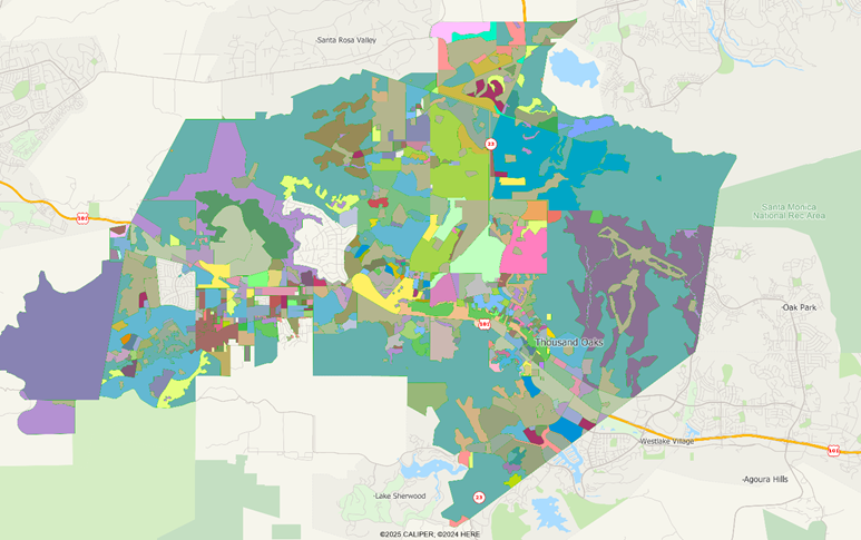
The major zones in pink include R-0 through R-3 which are at increasing density, but also a designation RPD – residential planned development. As if this were not complex enough, the detailed zoning map includes 130 separate land uses, the vast majority of which occur only one time – these are almost always the exceptions to the general rules. The resulting map is completely disjointed:
To make matters worse, the zoning codes used by adjacent authorities, even those within a single county, are not harmonized. While most zoning codes that start with “R” are residential, beyond that comparisons become very difficult. An R-2 designation in one town might be similar to, but not exactly the same as the very same designation in the next town and there will be sub-areas within the R-2 where exceptions are made to one or more of the defining characteristics of the zone.
While differences can be minor, in practice they can be crucial. We don’t expect to see harmonized coding any time soon and attempts at doing so will not obviate the need for a detailed examination of the meaning of the code in a particular case.
Even when the existing zoning seems to match plans, municipalities can almost always find a way to block a development if they so desire. In Thousand Oaks, a K-Mart store closed many years ago and was sitting vacant. For several years, Home Depot wanted to open a store there, but the town effectively blocked their development. The property is, after twenty-five years, a vacant building, and is now being developed as a high density residential complex.
The town blocked development because of “zoning incompatibility”. The site was zoned C-1, a neighborhood shopping center, but the town said that the site was inappropriate for a large scale regional retailer like Home Depot. This despite the obvious fact that K-Mart was a large scale regional retailer, at least during its prime, and the site was never a “shopping center” in the traditional sense. Compatible zoning can be easily blocked by local councils – and yes, you could likely take them to court if their decisions seem unreasonable, but even a large retailer like Home Depot instead just said ‘where in town will you let us build?’ and quickly pivoted.
We prefer land use maps for visualizing what is actually built on the ground, but clearly zoning maps are a useful tool for understanding the development standards for individual properties. Note, however, that even if your national parcel database has the zoning code for a property, you do need to consult with the local jurisdiction to understand the details of what is legally permitted.
Whether you will actually be allowed to develop a site? Different matters altogether, since zoning ordinances are often specifically written to allow local jurisdictions the ability to decline almost any development for almost any reason.