The massive wildfires of January 2025 resulted in significant loss of life and property in two main areas of Los Angeles – Altadena in the San Gabriel Mountain foothills and the Pacific Palisades and Malibu up the coast from Santa Monica.
AGS has been actively tracking both these areas to first determine the likely loss in population but also to identify areas where significant rebuilding is occurring. The difference between our January 1, 2025 estimates (just days prior to the fire) and our January 1, 2026 estimates (to be released in a few weeks) is striking. The map below shows the loss of households in these census blocks in the shades of brown.
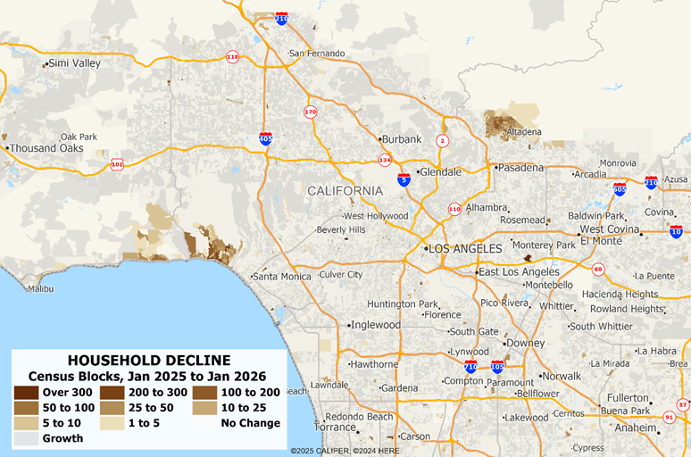
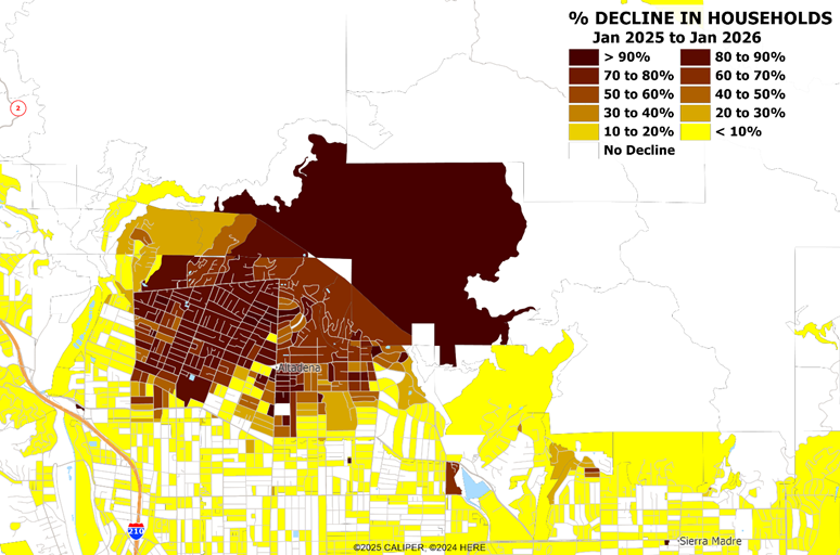
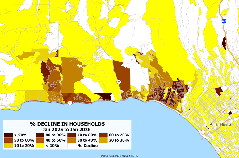
The devastation levels range from ten percent in some blocks to one hundred percent in the most affected neighborhoods. Detailed maps of each area showing the percentage decline in households are below.
At the time of the disasters, city and state officials promised to streamline processes for permits and redevelopment. Encouraging progress is clearly visible in Altadena, where building permits over the first three quarters of 2025:
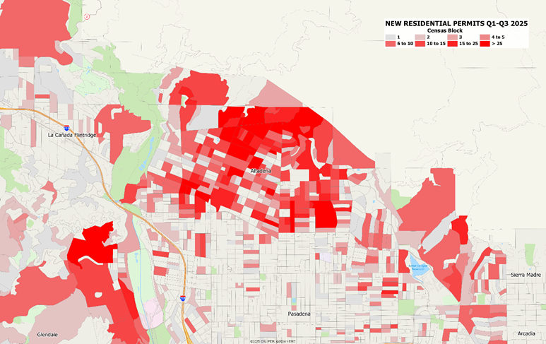
Given the rate at which permits are now being issued, this area will be rebuilt relatively quickly. Altadena appears to be getting the Servpro treatment – “like it never happened” – and we expect that rebuilding will be complete within five years.
However, the situation in the Malibu and Pacific Palisades is radically different, with nearly no permits issued in the primary burn areas of the Palisades:
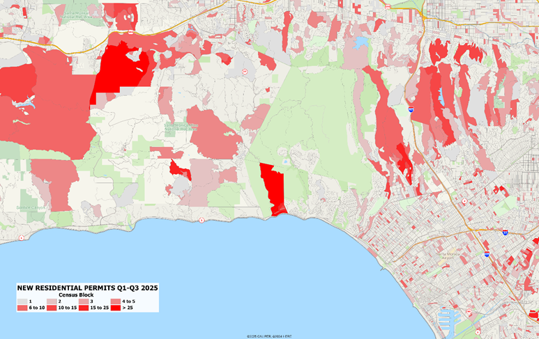
One major development can be seen in the block near Topanga Canyon which had a large and very expensive mobile home park sitting at the top of the bluff. This appears to be in the early stages of what should be rapid redevelopment.
However, in the Palisades and along most of the Malibu coast, there is next to no permit activity. This is likely due in part to the influence of the California Coastal Commission, who tend to disfavor any development (or redevelopment) near the ocean. Local news sources have repeatedly stated that major land assembly by corporate interests is occurring, as owners simply do not have confidence that they will be able to rebuild over the next few years. When this area is redeveloped, it will likely be at much higher density.
For users of demographic data, the handling of major disasters such as this is of critical importance. Most demographic estimates use models which assume gradual rather than catastrophic change and rely upon top-down type models which simply do not capture rapid changes well. Other models may rely on single source local data such as the postal service which often do not change quickly – for example, the post office continues to recognize addresses even when the house no longer exists, making this data source almost unusable in catastrophic circumstances and slow in recognizing the abandonment of housing.
The AGS methodology relies on a deep range of micro-scale data sources which broaden these common and flawed sources, including tracking changes in parcel geometry and ownership, building footprints, building permits, the use of private delivery statistics, and new street segments. In areas of significant change – both disaster areas and high growth areas – we supplement these sources with a systematic analysis of the latest satellite imagery to determine the scale and progress of development projects. With disaster zones, our focus is on identifying reconstruction at various stages, linking imagery to specific properties and building permits issued.
Superior methodology and investment in source data is often not easily recognized, but how a data supplier handles major catastrophic events and their aftermath should give users great confidence in the estimates in areas with less drama.