
When the Census data is released every ten years, the geographic boundaries change. The 2020 Census provided unique challenges with the data and geography that we have extensively covered on the blog. To best serve our clients, we carry a complete range of standard census based cartography which is available on either 2010 or 2020 boundaries – all the way from census blocks and higher. We have been working with the 2020 boundaries and data from the beginning and offer current year estimates on either boundary set. But that is just the beginning of what we can do geographically for our clients.
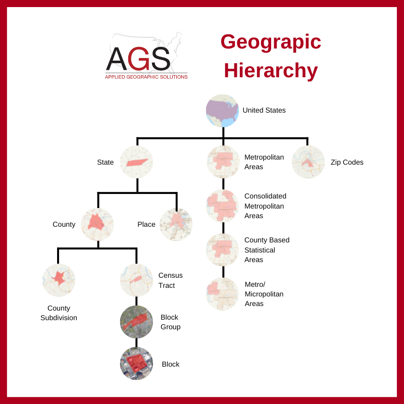
First, we offer clients both 2010 and 2020 based data at no additional charge and have for more than one year. This covers everything from historical census data to five year projections, delivered on either or both geographical bases. The chart below shows the geographical hierarchy that AGS supports. Additionally, we also have our own zip codes which we do with Scan/US. These are high quality boundaries that are offered at very affordable prices.
Many of the mobility data providers work on the 2010 block or block group base and have been reluctant to change over to the new boundaries because of the massive volumes of data which must be recomputed. If any of our clients have any data based on the 2010 boundaries, we can convert it for you to 2020 block groups, if you would rather use that geography. We have an article all about why you should be using the 2020 geography now. You can find that here: Taking The Plunge: Why You Should Be Using the 2020 Geography Now – Applied Geographic Solutions
We can use any set of standard GIS format files and provide current year data, so if clients have territories based on 2010 geography, and need it recast on 2020 boundaries, we can do that. We can also create custom layers for clients to use within our Snapshot desktop and API environments. We can easily swap back and forth between boundaries so that our clients have exactly what they need.
When you are looking at data providers, their geographic capabilities are an important capability that should be considered. The team at AGS are here and willing to help you navigate these boundary changes with ease. After all, we’ve been at this since before GIS was a thing.

Recent Comments