
The growth of any urban area is highly dependent upon its geographic situation, and much has been written about the particular locational advantages that resulted in the complex urban systems of modern America.
Why did Pittsburgh develop as a major steel manufacturing center? Located at the confluence of the Monongahela and Allegheny Rivers which join as the Ohio River, the location afforded inexpensive water transportation of the raw materials necessary for steel production: coal and iron ore. But its particular shape is a function of topography and transportation – as the city grew, it did so along major transportation arteries that led to the city center. Along the way, there are gaps in the urban areas of more rugged terrain.
The typical pattern of urban development is along lines of equal accessibility to the downtown core. Routes which radiate from the center develop first, followed by infill along ring routes. In many cases, development will precede proposed routes. A great example of this is the pattern of development in Charlotte, where the I-485 ring route fundamentally changed the path of expansion as the city grew.
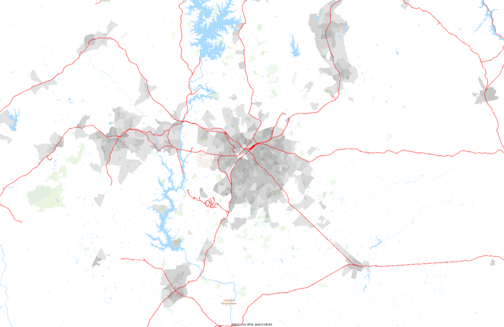
In 1980, the city was compact but had ‘fingers’ radiating out towards towns to the west, northeast and southeast:

If we add the railway network, we quickly see that development has occurred initially along rail routes:
This state highway map from 1980 shows the major routes in the area:
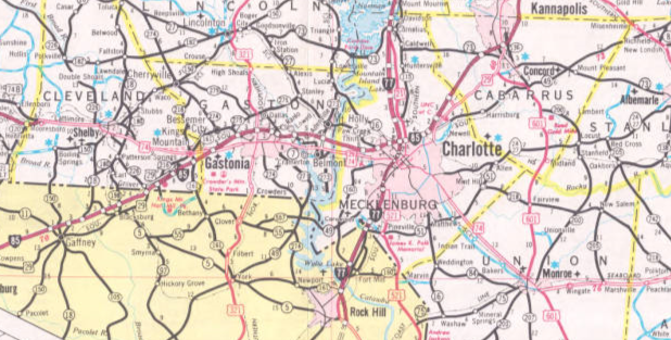
I-77 and I-85 are the major freeways in the area, connecting Charlotte to Gastonia, Kannapolis, and Rock Hill. Fast forward forty-five years, and the pattern of development continues to reflect the rail network, but is much more strongly influenced by the construction of the I-485 beltway, which allowed for infill between the I-77 and I-85 freeways:
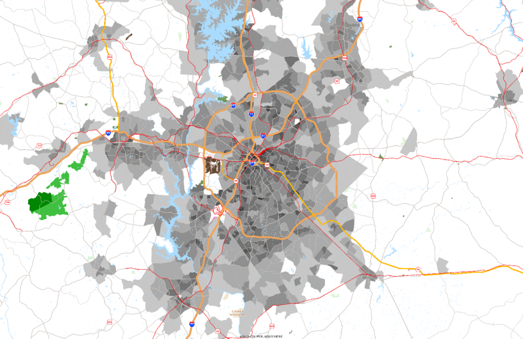
Over the years, the radial expansion has blurred the distinction between the original cities and the beltway allowed infill between them. The major gap in density at the western junction of I-85 and I-485 is the airport, and the gap at the southern junction of I-77 and I-485 is a major rail hub.
So, what’s the point of this? Population projections should be informed by planned transportation links – both fixed transit lines (subways and light rail) and new freeways. Fixed transit lines will tend to result in higher density redevelopment at stops along the route. New freeways provide significantly greater accessibility to areas relatively distant from downtown, resulting in substantial development opportunities.
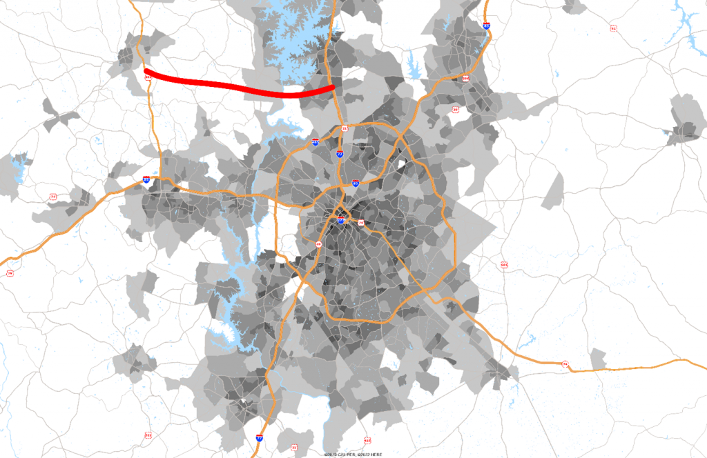
NCDOT is in the early stages of linking I-77 from the Lake Norman area west to the NC-16 freeway, which will eventually extend west to US-321 at Lincolnton. The map below shows the general route and projection models should be adjusted accordingly:
Since projects such as this generally result in changes to growth patterns, a robust population projection system requires constant monitoring for information related to proposed and approved transportation projects.

Recent Comments