Can you identify the cities in these maps without the familiar guidelines of transportation and water features? Each map is at 1:400,000 scale and shows only the relative density of households at the block group level – which makes it interesting because industrial areas are excluded from these maps.
Tell us how well you did by going to the blog post where you will find the answers.
| 1 | 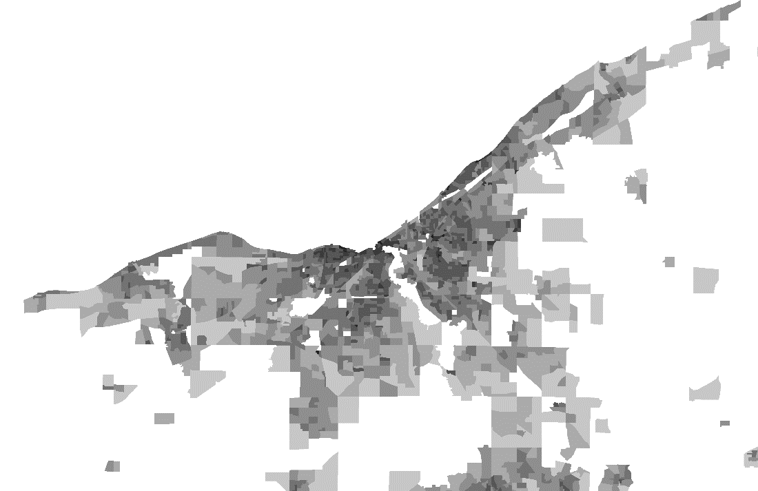 |
| 2 | 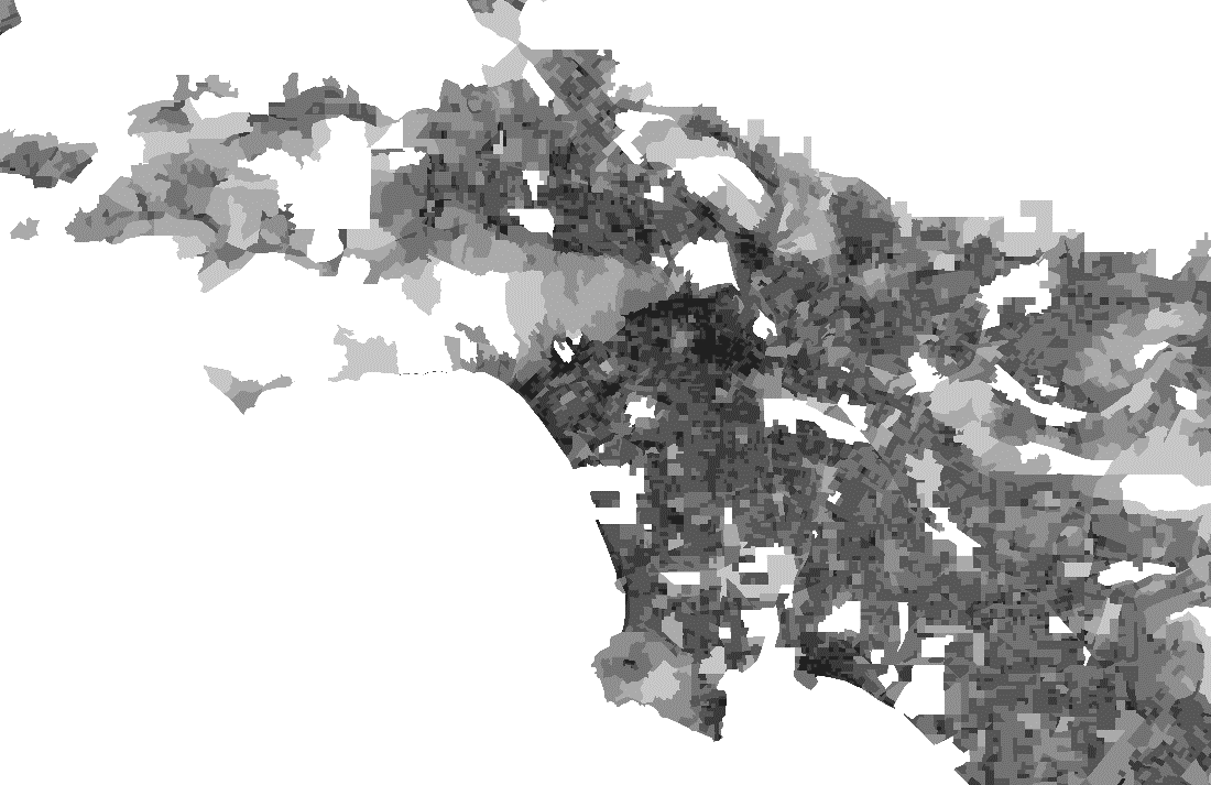 |
| 3 | 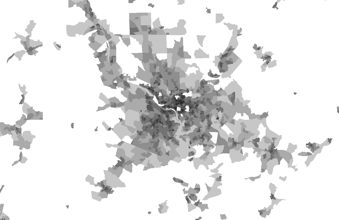 |
| 4 | 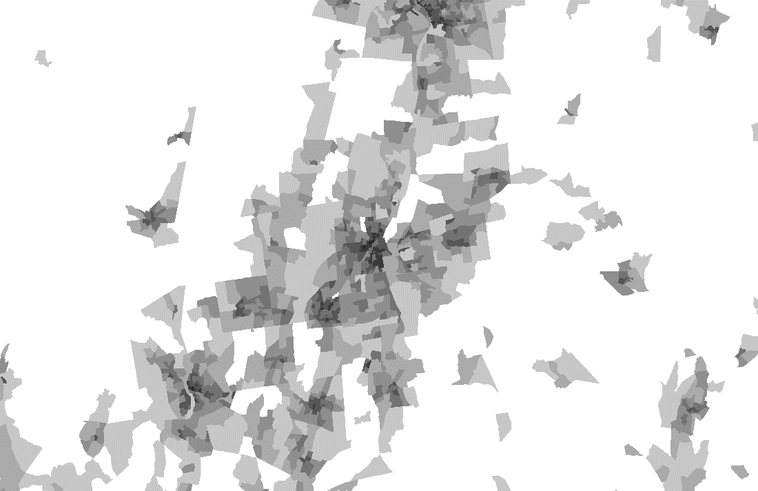 |
| 5 | 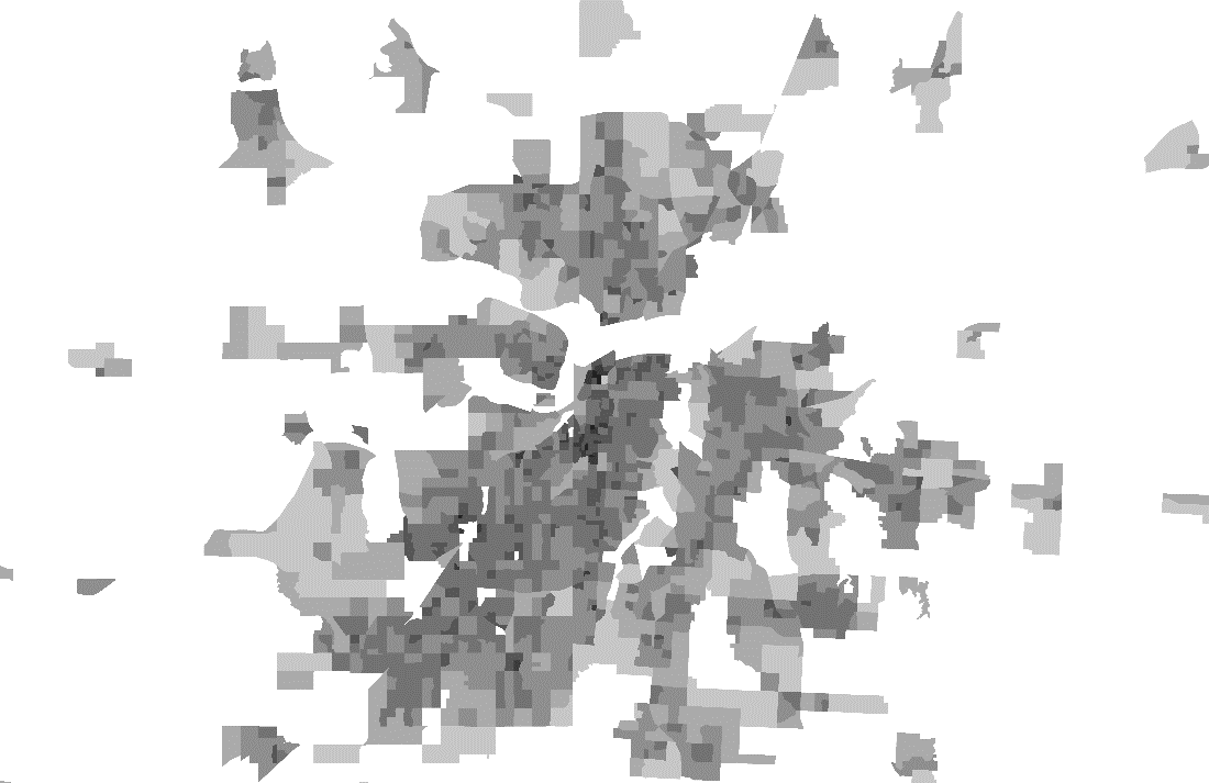 |
| 6 | 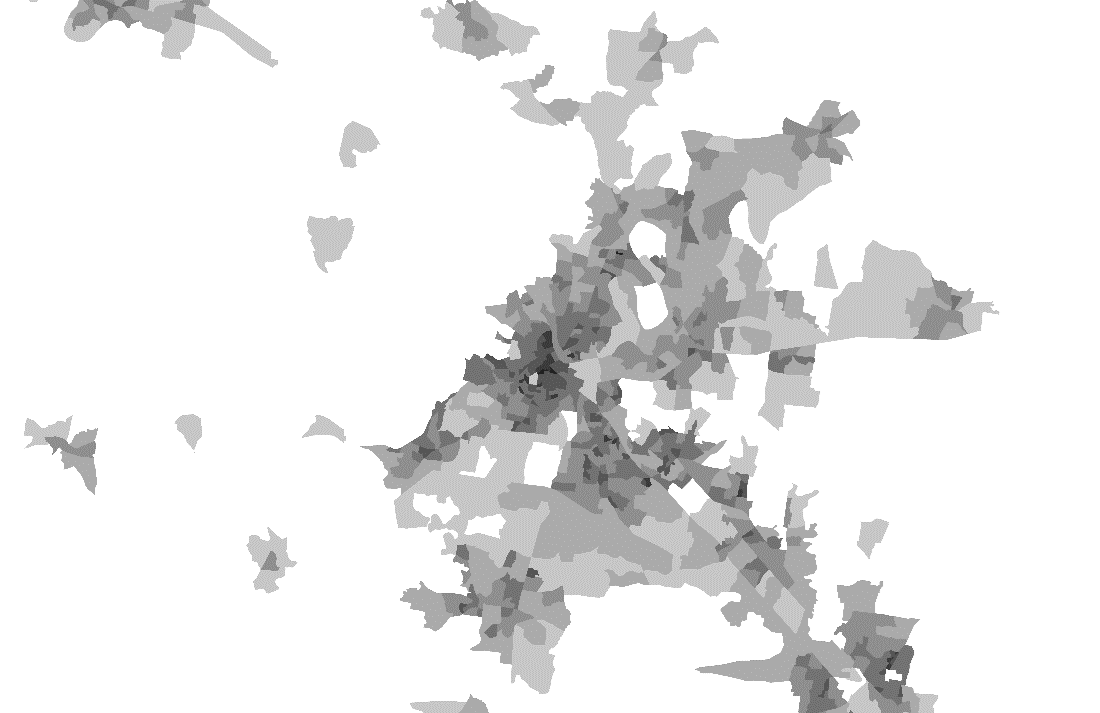 |
| 7 | 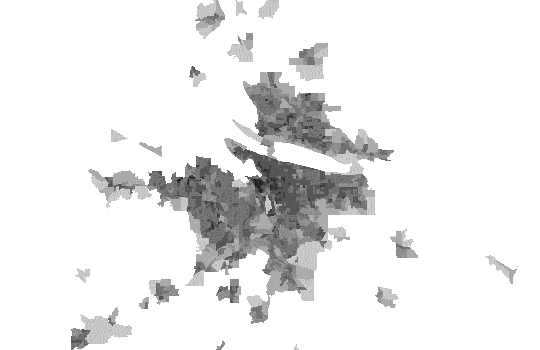 |
| 8 | 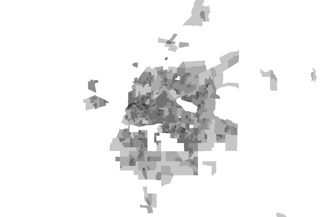 |
| 9 | 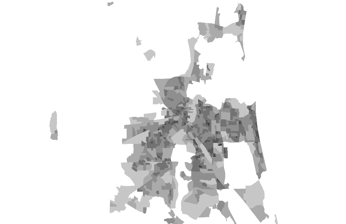 |
| 10 | 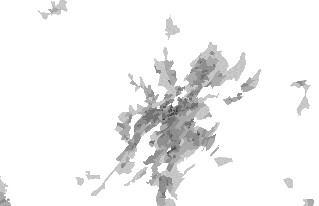 |
| 11 | 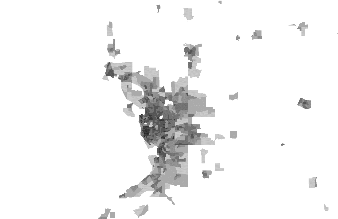 |
| 12 | 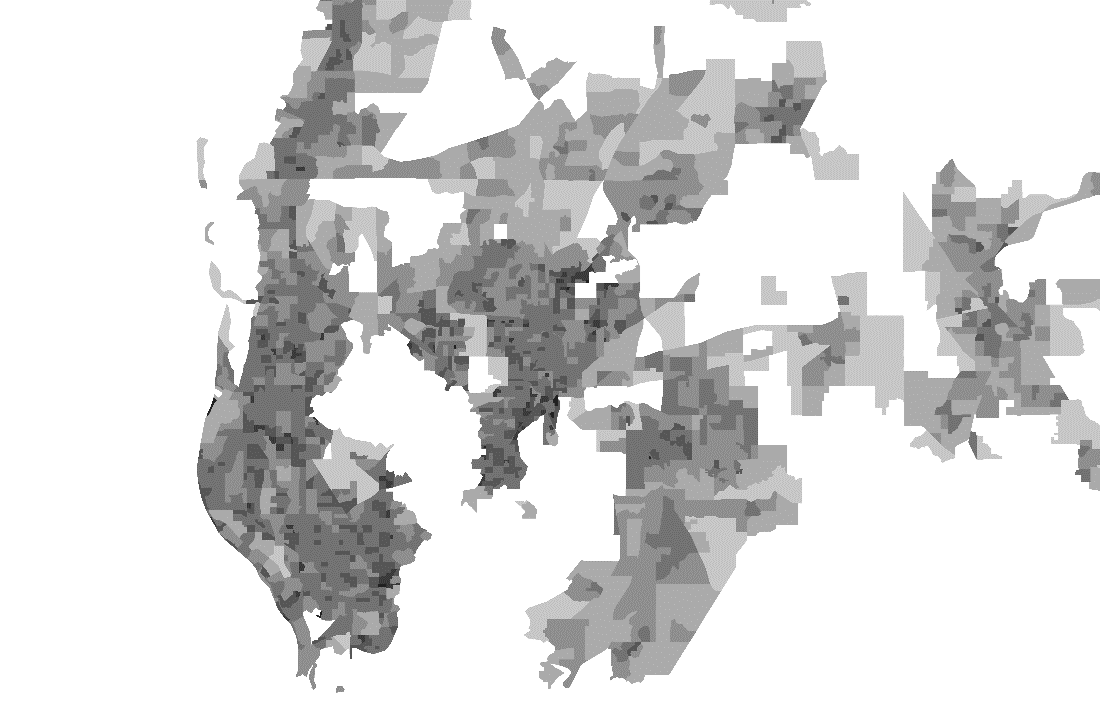 |
| 13 | 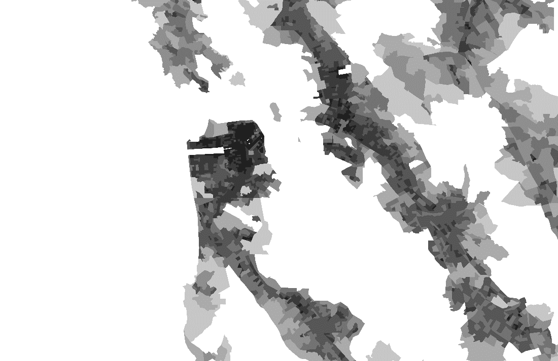 |
| 14 | 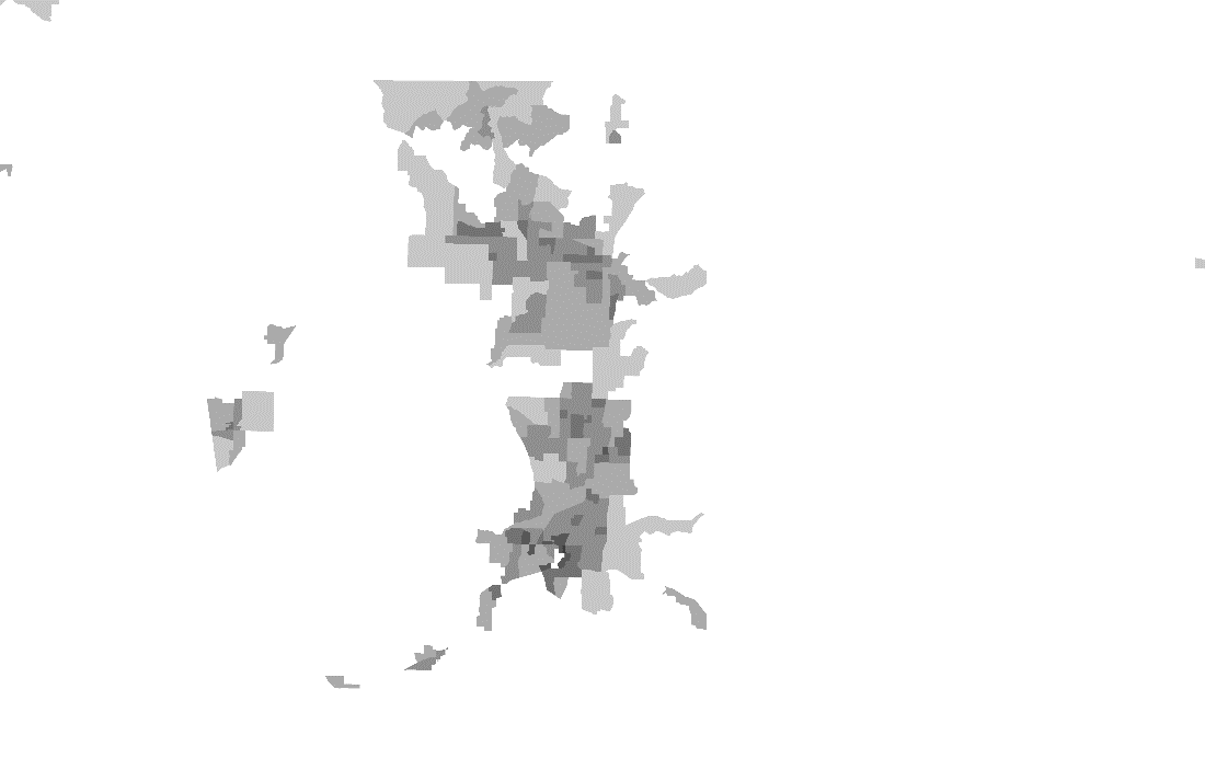 |
| 15 |  |
| 16 | 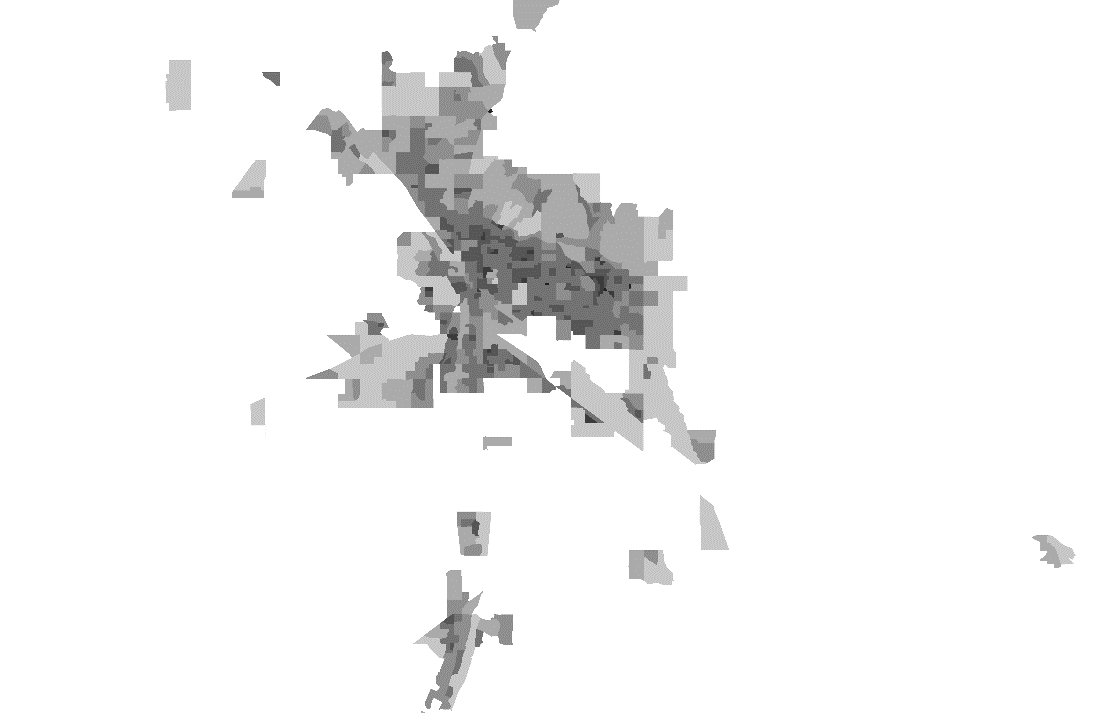 |
| 17 | 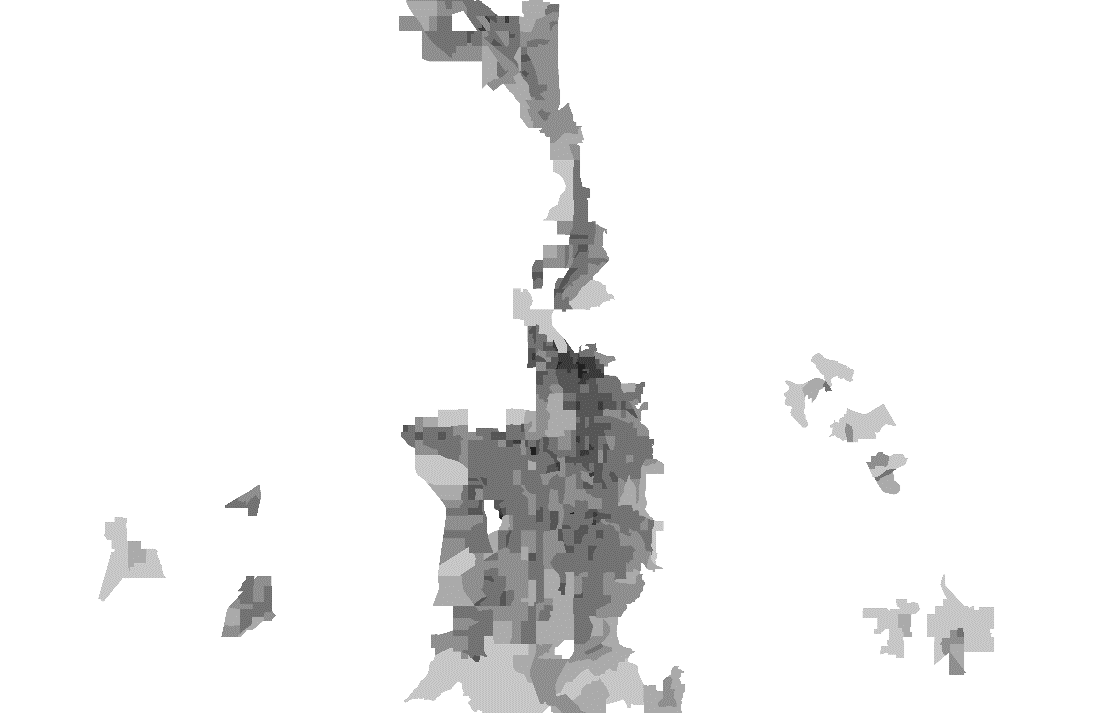 |
| 18 | 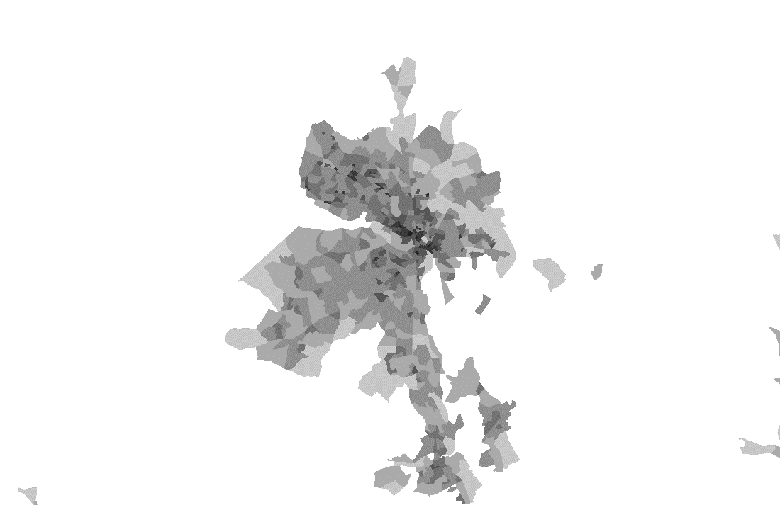 |
| 19 | 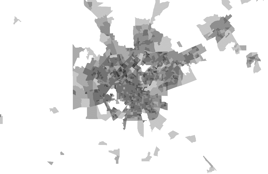 |
| 20 | 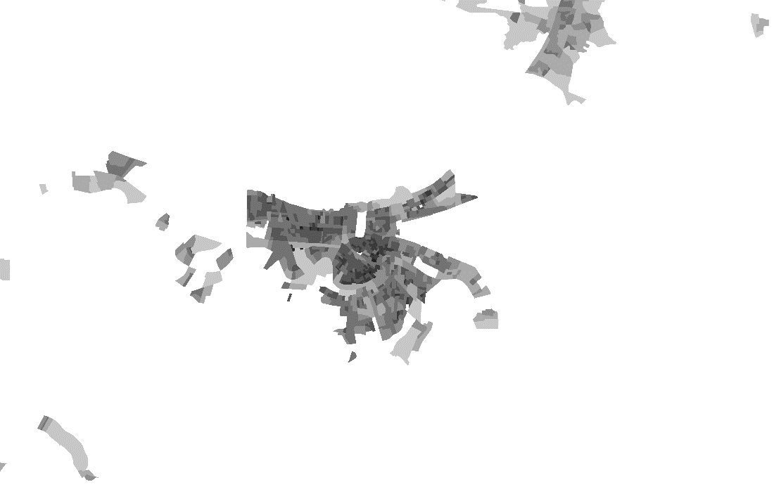 |
Need help? Here is a bank of cities that you can match the ink blot maps to.
- Birmingham, Alabama
- Hartford, Connecticut
- San Antonio, Texas
- Buffalo, New York
- Portland, Oregon-Washington
- New Orleans, Louisiana
- Albuquerque, New Mexico
- San Francisco, California
- Tampa, Florida
- Jacksonville, Florida
- Nashville, Tennessee
- Pittsburgh, Pennsylvania
- Fayetteville-Rogers-Bentonville, Arkansas
- Los Angeles, California
- Richmond, Virginia
- Tucson, Arizona
- Salt Lake City, Utah
- Kansas City, Missouri-Kansas
- Cleveland, Ohio
- Memphis, Tennessee-Arkansas-Mississippi