
Over the last few months, we have been asked if we have data for H3 polygons. This ties in quite nicely to our discussion a few weeks ago about the MAUP, or modifiable areal unit problem. H3 is a system of spatial indexing developed by Uber Technologies a few years ago, which tessellates the globe into regular size hexagons at different scales. So, we thought we would look into them.
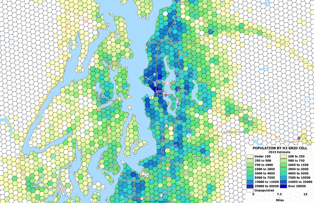
The map below shows level 8 hexagons for the Seattle area, shaded by 2023 population.
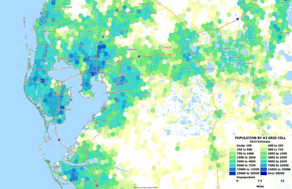
The hexagon presentation, especially without the boundaries outlined, we admit just looks cool. We have been using square grids for years, and if we are honest, they just don’t have the same cool factor as hexagons. The map below, without the boundaries outlined, shows the visual attraction of hexagon grids – almost to the point of giving an additional level of credibility.
On the plus side, the H3 hexagon grids have some major benefits:
- Consistent size areas make interpretation simple. With areas such as block groups or zip codes, we often find that our eyes are drawn to the big areas at the edges of cities, possibly distorting our interpretation of the map patterns. With consistent size units, patterns are easily discerned.
- They have the desirable property that any point dropped within a hexagon is guaranteed to be closer to its own centroid than to any other. Because the H3 scheme is primarily for the purpose of spatial indexing, the naming conventions are such that data can be easily linked and computed for any cell.
On the down side –
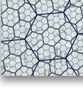
The hexagons do not nest well, meaning that you cannot simply take a set of hexagons at one level and aggregate them to the next (see the image below). A regular square grid, while not as visually appealing, does have the advantage of being nestable – and for many purposes, computationally superior to the hexagons.
- The hexagons are sloppy and need to be clipped at shorelines in order to look good. Each level needs to be processed individually.
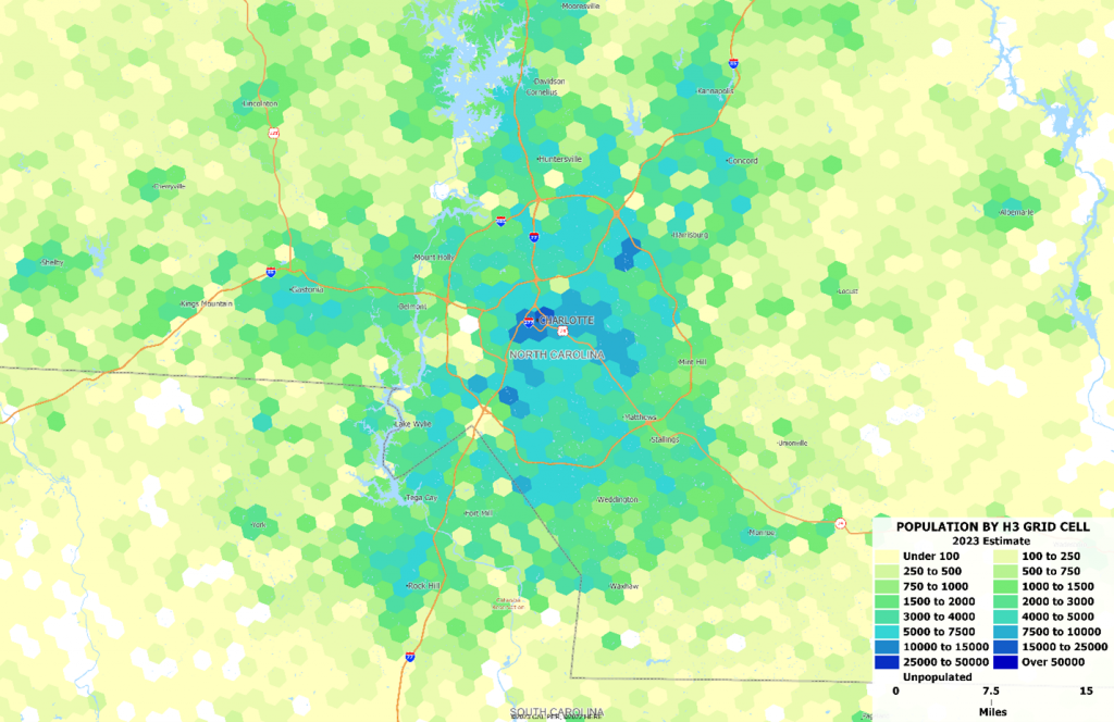
- In areas without shorelines, interpretation can be difficult because the normal shapes which can be seen on block group level maps – rivers, major roads, and administrative boundaries – aren’t present. These often give readers some interpretation guides, and we find that in order to show the guideposts well, you need to obscure some of the details which can defeat the purpose of the map in the first place. Even determining that the area below is Charlotte NC can be difficult because our usual state, county, and water delineators are difficult to identify.
At the end of the day, we like these for some purposes and greatly dislike them for others. Nevertheless, our 2024A data release will include all of our databases aggregated from the census block to H3 grid cells at several levels. Clipped to shorelines, of course, and with cartography available in several common GIS formats.

Recent Comments