
Forecasters at the NOAA are predicting an above average year for hurricanes.
“NOAA’s Climate Prediction Center is predicting another above-normal Atlantic hurricane season. Forecasters predict a 60% chance of an above-normal season, a 30% chance of a near-normal season, and a 10% chance of a below-normal season. However, experts do not anticipate the historic level of storm activity seen in 2020.
For 2021, a likely range of 13 to 20 named storms (winds of 39 mph or higher), of which 6 to 10 could become hurricanes (winds of 74 mph or higher), including 3 to 5 major hurricanes (category 3, 4 or 5; with winds of 111 mph or higher) is expected. NOAA provides these ranges with a 70% confidence. The Atlantic hurricane season extends from June 1 through November 30.”
Between now and the end of November, we can expect to see 3-5 major hurricanes hit to U.S. coastline. Over the years, these storms have done significant damage to homes and businesses.
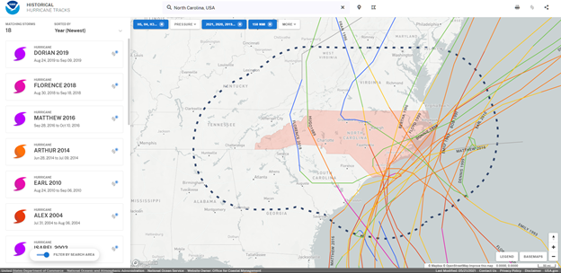
Using Hurricane Track data from 1870 to the present, we can see patterns of major storms on the North Carolina coast. The map below shows category 3 and higher storms. This map was made on this site, courtesy of the National Ocean Service.
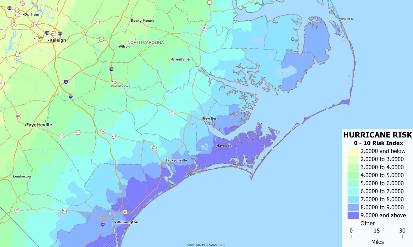
North Carolina often has hurricanes pass through but less often come onshore in the state. The eastern shore of North Carolina is very low lying and includes the Outer Banks. The map below shows the hurricane risk index.
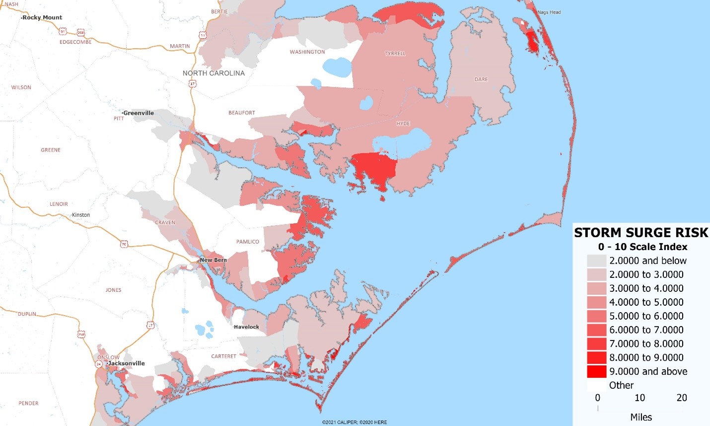
Below is a map of our storm surge index for the northern coastline of North Carolina. Hurricane damage is especially severe in low lying coastal areas, not just because of the damaging winds and rivers that overflow their banks, but because of the storm surge that usually accompanies the eye of the hurricane. This maps demonstrates the heightened risk to the low lying marshlands of the Carolina coast and the sand dune Outer Banks. Storm surge can cause serious damage to homes and businesses, making it important to predict the additional risks that hurricanes bring.

Recent Comments