
California, especially the southern parts, is famous for its variability in rainfall. The ‘average’ annual precipitation figure is a poor indicator of reality. Most seasons are well below that average, which is raised by the occasional very wet winter. The rainy season is short – generally between mid-December and early April – and highly unpredictable.
The winter of 2020-2021 was a dry one, and with the famous gray May and June gloom rapidly giving way to summer heat, the hills are unusually brown for this time of year.
CalFire reports thirty-one named fires since June 1 alone, from San Diego in the south to Mendocino in the north. The last few years have been particularly trying for Californians, and this year already promises no respite.
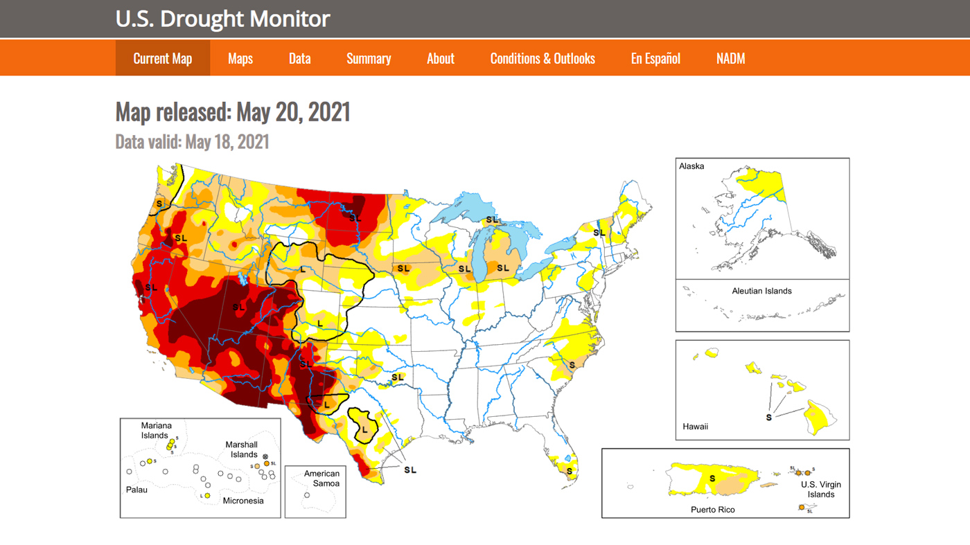
The current drought map shows the extent of the problem, with extreme drought conditions from west Texas to the California coast and as far north as the interior of Washington and Oregon.

Much of the terrain of the west is rugged, and fire fighting is costly and dangerous. Fires, whipped by the Santa Ana winds, can quickly move through mountainous areas and threaten populated areas. As residents of the city of Ventura discovered a few years ago, wind-borne embers can ignite house fires several miles away from the “urban-wildland interface”.
The map below shows the risk of wildfire in San Diego County. As you can see, most of the area is susceptible to fires inland from the coast and north to Temecula.


Recent Comments