We’re excited to announce that Mexico demographic data is coming soon to the AGS data library! This new release expands our North American coverage with a rich set of geographic and demographic variables—available at multiple levels of detail, from national and regional views down to local “block group”–style geographies.
Our new dataset offers an in-depth look at population density across Mexico. As shown in the population density map using hexagon level 6 geography, the northern region of Mexico and parts of the Yucatán Peninsula are sparsely populated, shaped by the region’s rugged and arid landscape in the North and lush tropical jungles in the South. In contrast, the central corridor—from Veracruz through Mexico City to Guadalajara—holds a substantial share of the population, reflecting Mexico’s historical and economic core.

At the local scale, AGS provides data comparable to a U.S. block group, combining rural localities and urban AGEBs (Basic Geo-Statistical Areas). This hybrid geography offers fine-grained insight into population patterns within cities such as Monterrey, Guadalajara, and Mexico City.
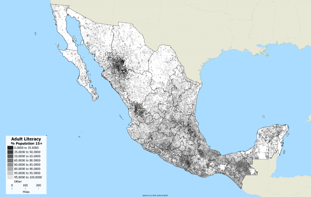
Mexico’s census data reveals compelling contrasts between urban and rural communities. Adult literacy rates are high in major cities but drop sharply in rural and mountainous areas, especially across the Sierra Madre Occidental and Sierra Madre Oriental ranges and in the southern state of Chiapas, where population density remains high but literacy lags.
Educational access is another critical factor. At the município level (roughly equivalent to a U.S. county), AGS data shows that in some areas, more than 40% of children ages 12–14 do not attend school. This measure helps identify communities where youth are entering the labor force early, often out of economic necessity.

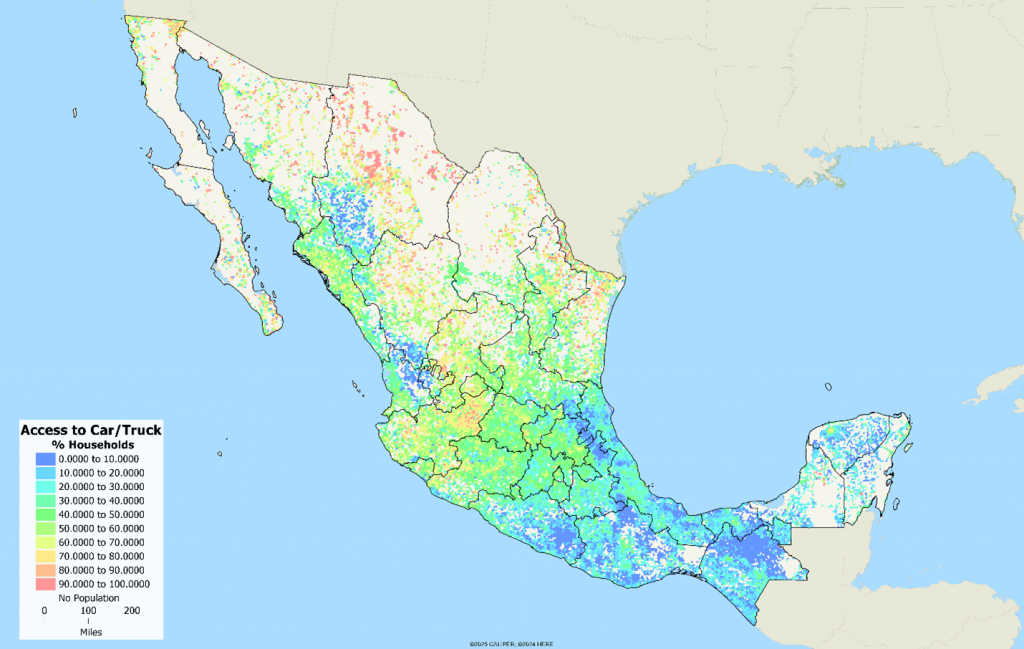
Our data also tracks disparities in access to household facilities and mobility. In many parts of Mexico, fewer than 10% of households have access to a vehicle, while ownership rates are higher in sparsely populated northern areas. Additional tables capture dwelling facilities such as access to electricity, running water, refrigeration, internet, and telecommunications.
The Mexico dataset includes variables for both the 2020 census year and current-year estimates (2025), enabling users to analyze change over time. Data tables are designed to reflect Mexico’s unique demographic and social structure, including:
- Employment status for the population age 12+
- Dwelling and household facilities, including infrastructure and durable goods
- School attendance by age group, including children 12–14 not in school
- Adult literacy rates and education levels
- Indigenous population by ability to speak Spanish
- Afro-Mexican population characteristics
- Tenure type, including households borrowing a dwelling from family (in addition to owner and renter categories)
- Marital status beginning at age 12+ (compared to 15+ in the U.S. and Canada)
Stay tuned for the official release in the coming weeks — and a closer look at how this data can power your next analysis.