
We’re thrilled to announce a new channel partner: CrimeRisk.ai, an innovative provider of environmental and crime data that helps clients make smarter, safer, and more strategic decisions. Their goal is simple: to deliver unlimited, on-demand crime and environmental risk insights mapped instantly across the U.S. Powered by advanced analytics and trusted national datasets, it’s designed for industries where location risk matters – real estate, insurance, public safety, retail, logistics, financial & investment institutions, and urban planning.
As commercial real estate professionals, site selectors, and market analysts know, location intelligence isn’t just about income levels and traffic counts—it’s also about safety. Whether you’re evaluating a potential retail site, planning a new residential development, or advising clients on branch expansion, understanding neighborhood crime trends and environmental risk is crucial.
CrimeRisk.ai delivers block-level crime risk mapping, powered by artificial intelligence and machine learning. Their platform goes beyond traditional citywide or ZIP-level crime statistics by offering hyper-local insights. This granularity helps eliminate guesswork and supports better risk assessments for:
- Property investment decisions
- Retail site selection
- Insurance underwriting
- Urban planning
- Public safety resource allocation
A benefit of Crimerisk.ai is the ease of their platform. Simply search for an address, explore the maps, and generate the reports. There are no usage caps, meaning that you can create as many reports as you need. Reports are created instantly and seamlessly and are ready for you to share with your team, tenants or key stakeholders.
Their crime data includes detailed breakdowns by type—murder, assault, burglary, robbery, larceny, and motor vehicle theft—with summary risk scores available at various geographic levels (including 1-mile and 3-mile radius rings), as shown in the example heat maps provided below.
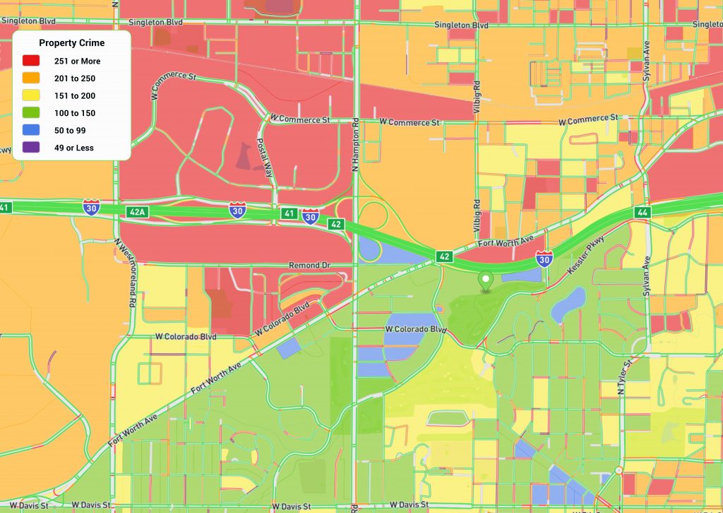
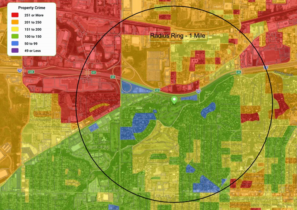
The color-coded heatmaps (ranging from deep red for highest property crime risk to blue for the lowest) give a fast, intuitive snapshot of crime patterns. Overlaying this data with key roads, landmarks, and radius rings helps users understand risk contextually within a site’s immediate trade area. At 3 miles out, risk scores drop to a more moderate level, demonstrating how quickly crime risk profiles can change across short distances.
Whether you’re an investor trying to avoid areas with elevated theft, or a national retailer looking to optimize store security spending, CrimeRisk.ai empowers you to act with confidence.
We’re proud to partner with a company that shares our commitment to data precision, innovation, and actionable insight.
Want to Learn More?
Visit crimerisk.ai or contact us to see how crime data can enhance your location strategy.

Recent Comments