
In 2015, we released the first version of Panorama, which found its home amongst the elite geo-demographic segmentation systems. As good as Panorama 1.0 was, after nearly a decade it was due for a fresh coat of paint.
Ten years ago, most of our modeling was done at the census block group level, and Panorama was primarily a block group level system with a block overlay covering the core variables which we were estimating at the block level. With our main estimates now at the block level and the 2020 census now fully released, we took the data down to the basement and put it on the rack.
Our main goal was to enhance the product without unduly disrupting a broad base of users who are now accustomed to the segment names and more importantly, the demographics they represent. We didn’t change the number of segments, but we seeded the whole process with the existing segments. The danger is that one then forces the world to view it as it did a decade ago, so we relaxed to let some of the segments ‘drift’ a little bit. Some segments got slightly more affluent, others a little younger, and still others more diverse.
The results, we think, are excellent. Moving to the more detailed level had exactly the effect we wanted – to show in micro-detail the diversity of neighborhoods on a block to block level. The examples below show the old and new Panorama segments for the same area of the small college town of Auburn, Alabama. Please note that we are not taking sides in the key question that divides the state, we are neither Auburn nor Alabama fans.
Block Group, Panorama 1.0

Block, Panorama 2.0
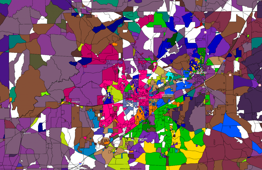
Note that the white areas are unpopulated, which in urban areas is usually non-residential land use. Clearly, there have been some shifts in segment representation in the city, but the main benefits are in the suburban and nearby rural areas which have much greater differentiation than in the past.
Check out the newly refreshed Panorama in our 2024A release.

Recent Comments