
The upcoming 2024A data release (May) for the United States will extend the range of available predefined geographic levels to include Uber H3 hexagons for detail levels 3 through 7 and includes updates to several standard geography levels. Any variable available in or derived from the library of nearly 60,000 attributes can be output for geographic areas from any one of these geographic levels.
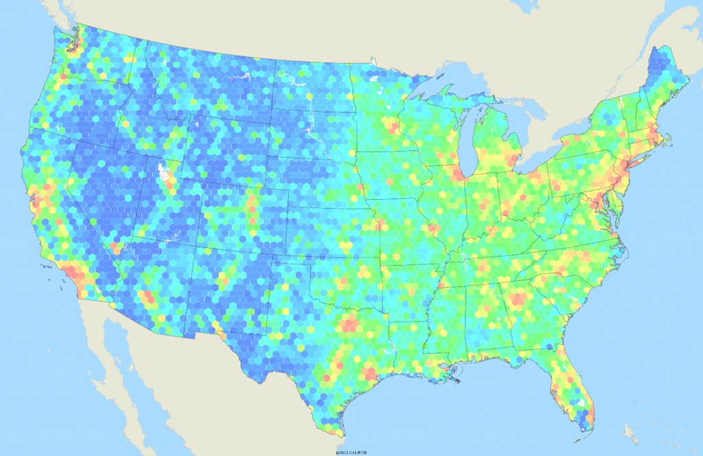
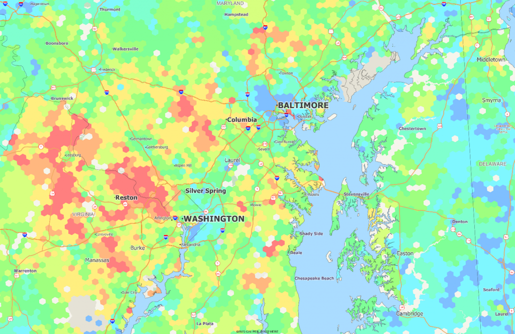
Applications using the H3 hexagon geographies will generally use levels 3 and 4 for national mapping, 5 and 6 for regional, and 6 or 7 for metropolitan level analysis. The first map below shows population density at level 4, and the second shows median household income at level 7 in the Baltimore-Washington area. Data for Canada is now available for these H3 levels as well.
Users are reminded that the 2020 definitions at the block, block group, census tract, and county levels are now outdated as the Census bureau will be reporting on the 2022 base moving forward. The 2022 base uses the new county level definitions for Connecticut.
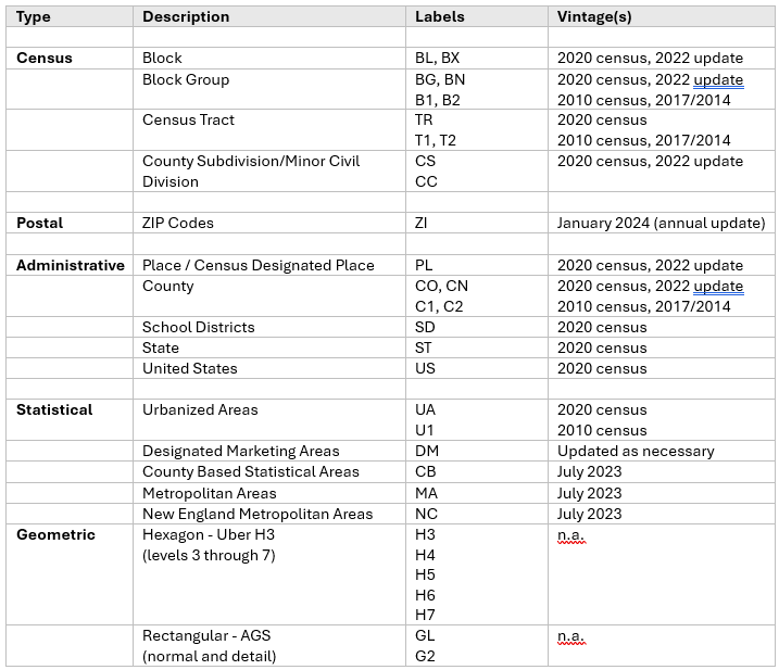
A full listing of the standard output geographic layers from AGS for the United States are:
The AGS production engine, Snapshot, can also be readily used to output data for custom geographic areas, such as territories, carrier routes, ZIP3, or other regular grid definitions. The BAT (block allocation table) is available for either the 2020 or 2022 census block base.
Cartographic files are available for most of these geographic levels without additional charge for use with AGS attribute data in standard file formats (ESRI shapefile, Mapinfo TAB, Maptitude CDF, and geojson).

Recent Comments