
While we are known for our demographic data, our geographic based data, like our suite of environmental data, has been trusted for many years by our clients. A wide range of applications benefit from these databases, including insurance underwriting, retail merchandising and real estate. In some cases, many of these variables are simply useful for reference purposes or general interest. As hurricane season approaches, how can our hurricane data benefit your business?
The AGS hurricane data, as a part of the larger weather risk category, but also available as a single data, has been a long time favorite for insurance underwriting. Coastal areas, like those in Florida, that are prone to hurricanes are often assumed to be at risk, but what other areas might have a smaller risk? Those with a moderate risk might not submit as many claims as those in an area with a very high risk, but it should still be taken into account for potential insurance claims in the future.
Real estate investors, or individuals looking to buy a second home for vacations, especially those looking to buy in an area not familiar to them might find themselves wondering what kind of environmental risks exist in the area that they are purchasing in.
Another use for this data is for grocery and convenience stores. During a hurricane, there is often a need for basic supplies like bottled water and canned foods, and stores in these areas could better predict stocking with environmental data.
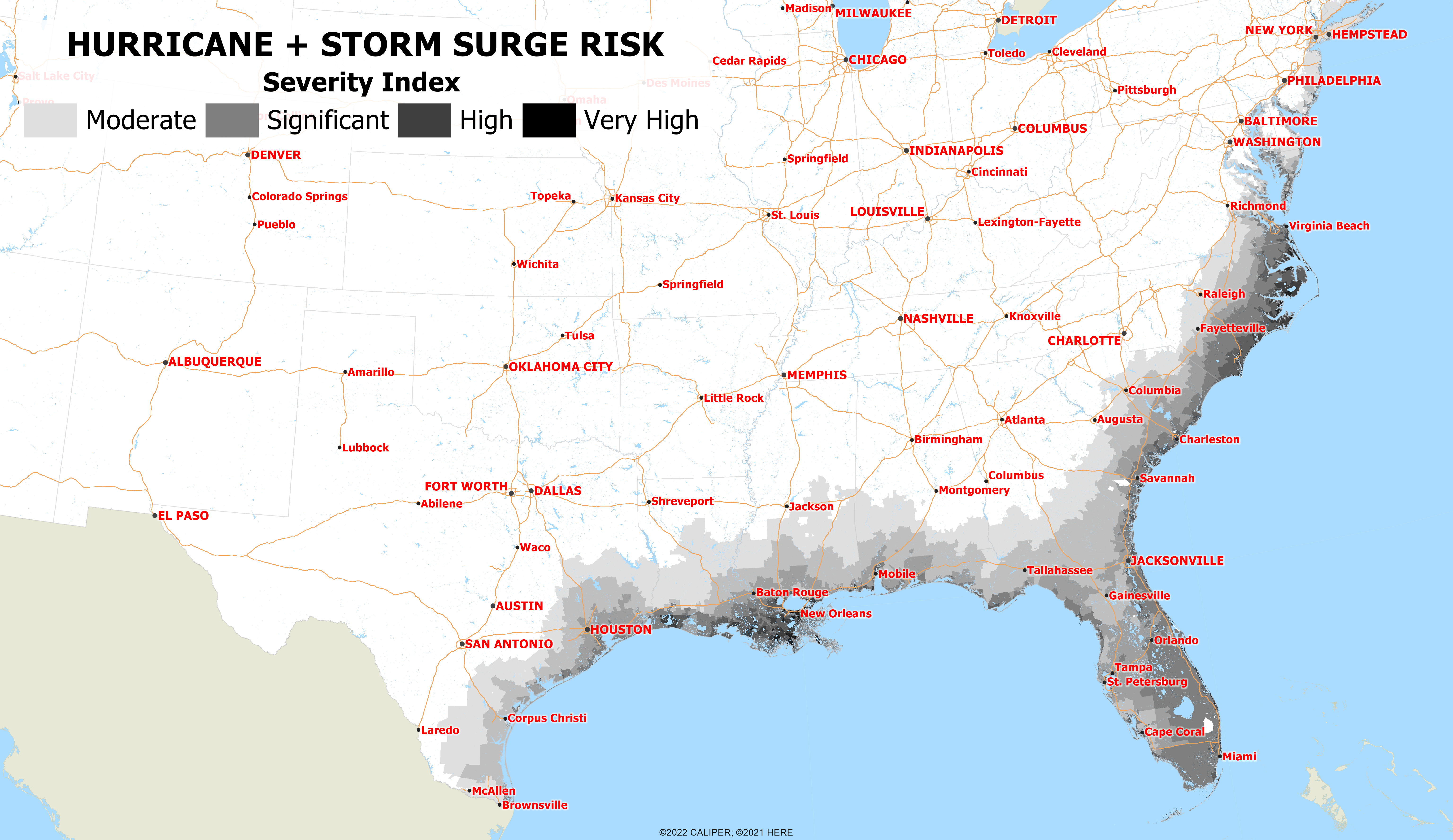
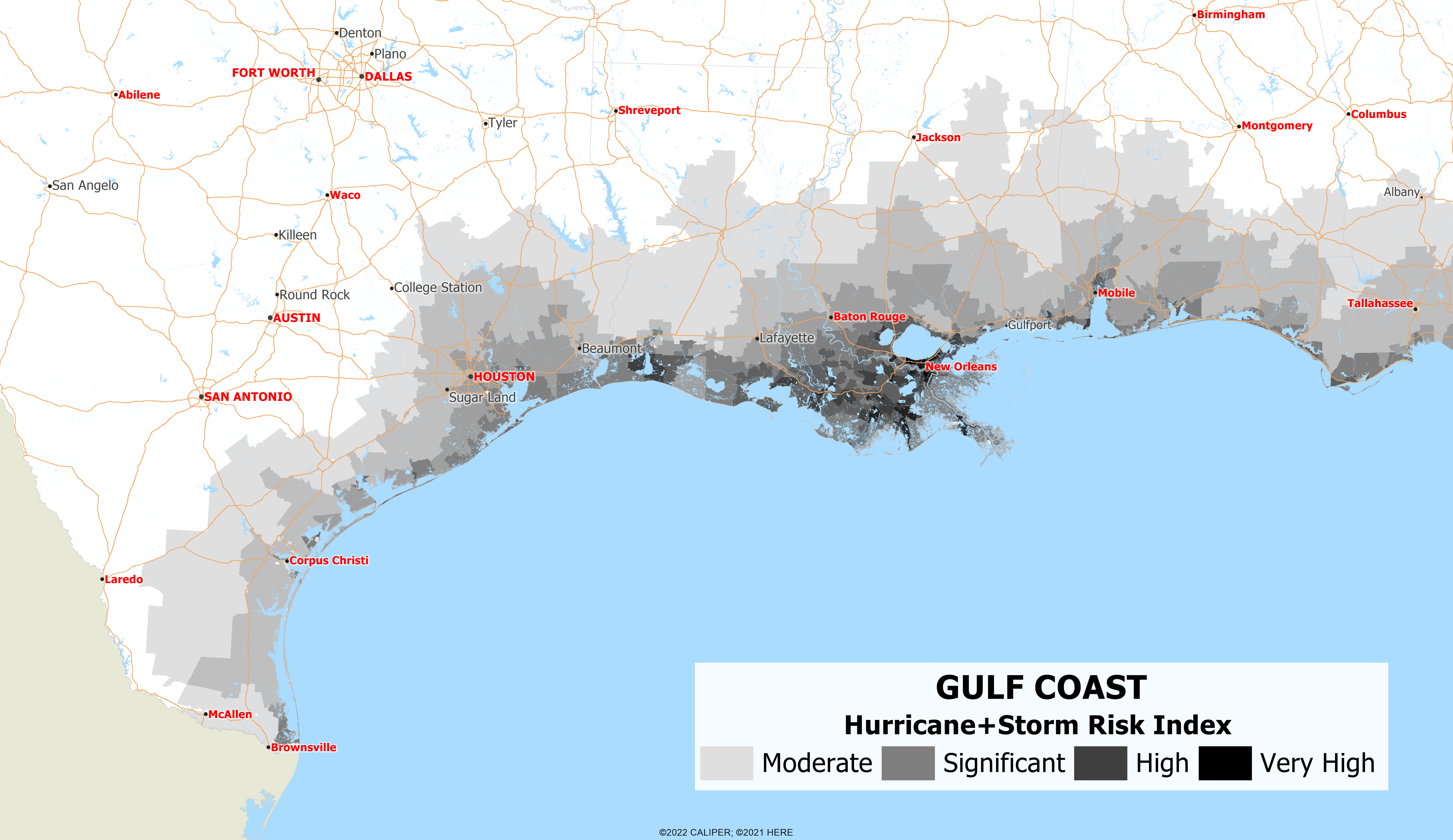
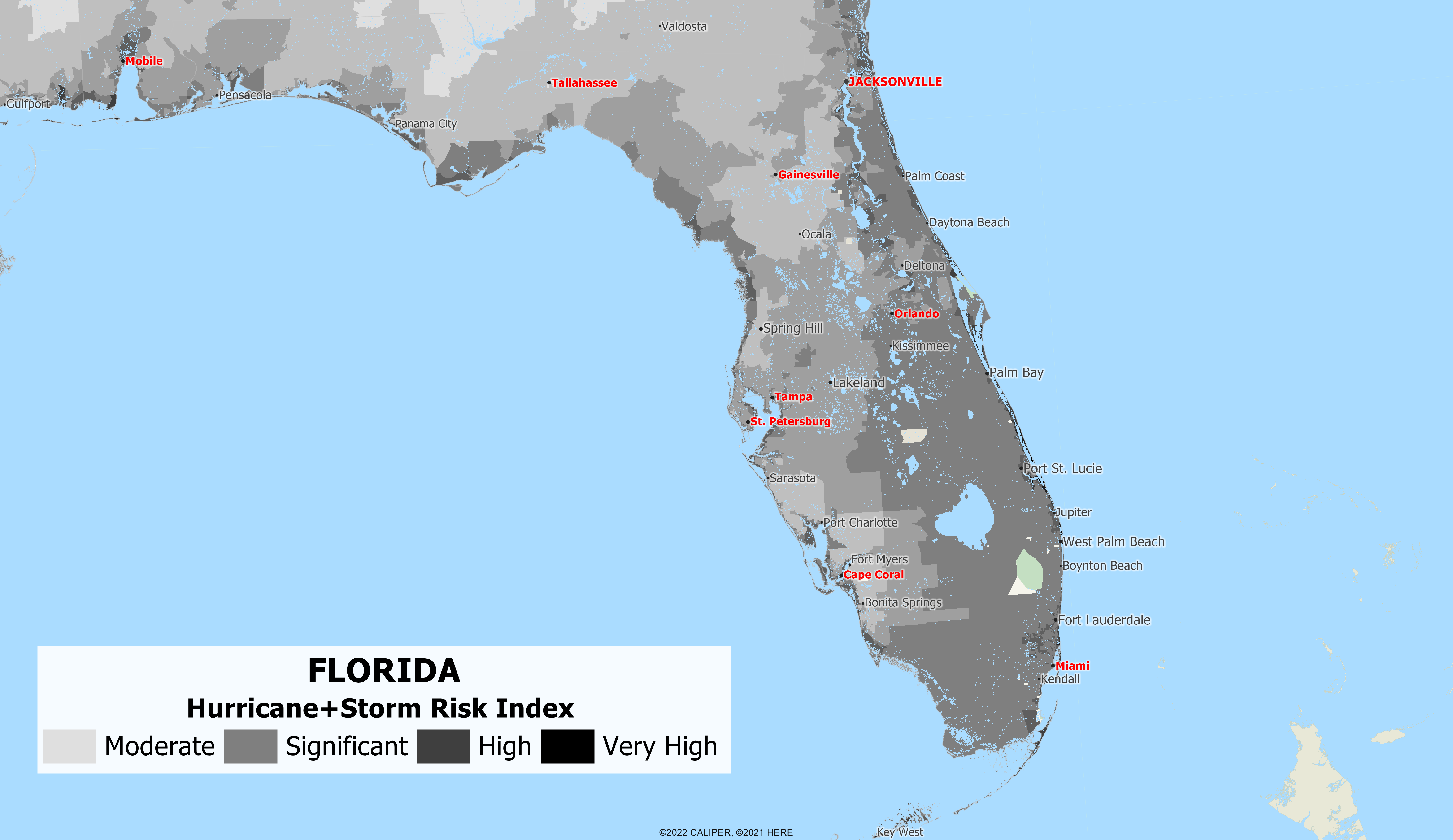
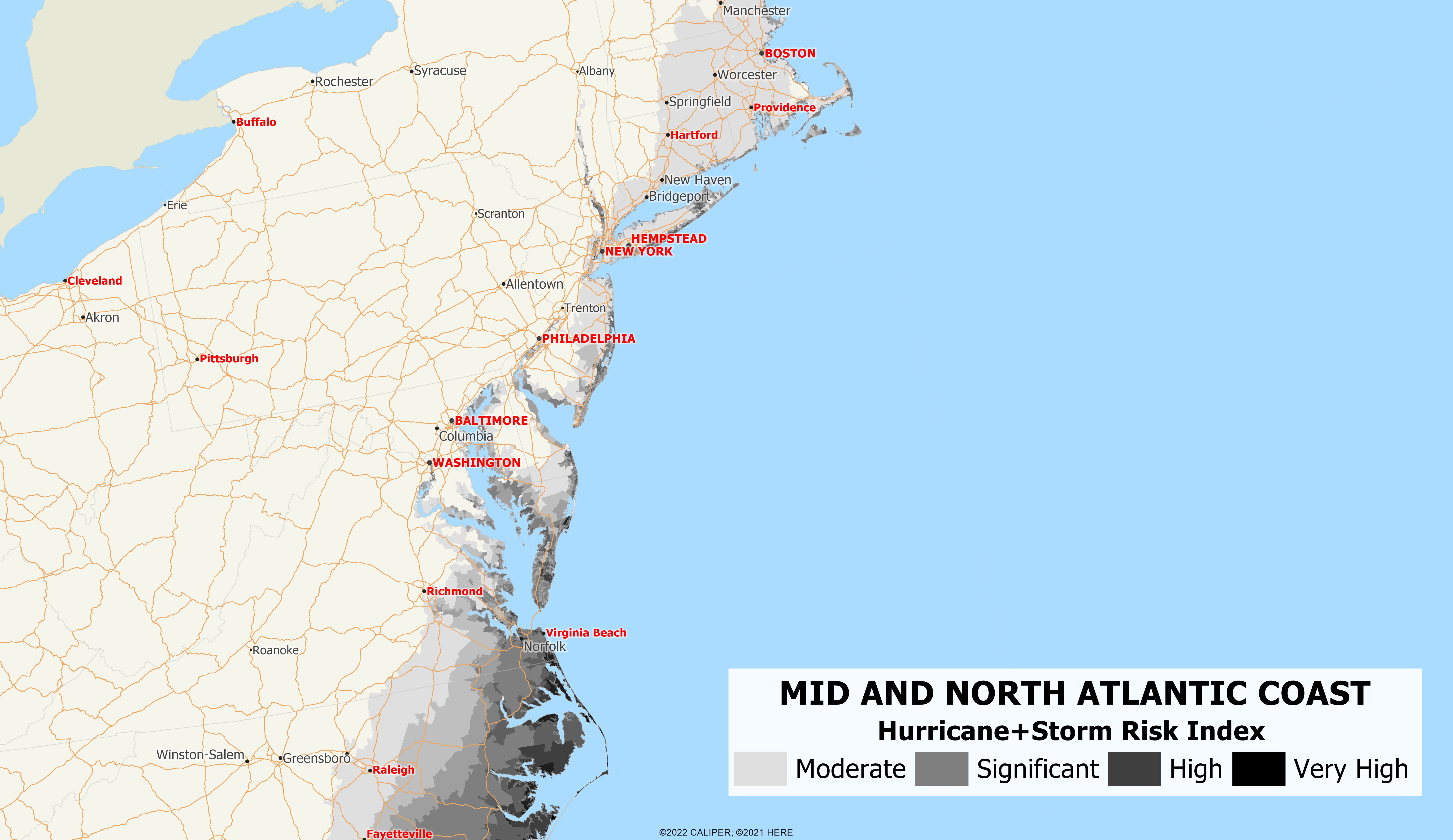
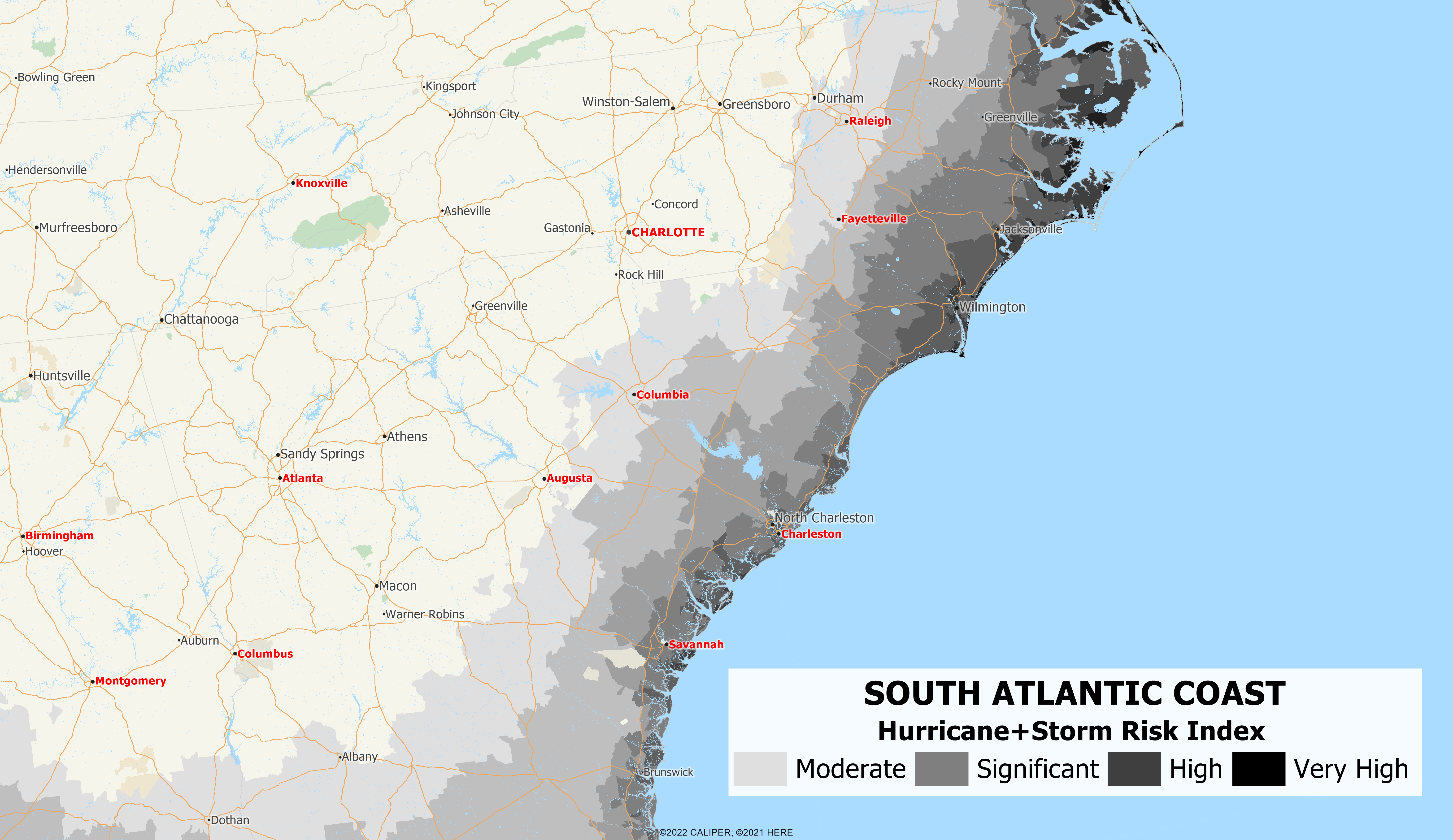
The maps below show various regions and the hurricane risk in those areas. The first map shows the East coast of the United States, while subsequent maps show various regions.

Recent Comments