
For many years, the standard detail geography which AGS has provided to users has been the census block group. Only those who read through our methodology statements knew that you could order your In-n-Out double-double ‘animal style’, since it certainly wasn’t posted on the drive-through menu board. Many were simply unaware that our core databases — estimates and projections, business/daytime, crime risk, and Panorama – have been modeled at the block level for years.
Given the ability to process large datasets extremely quickly in our Snapshot engine, we figured it was time that we posted some of the secret items on the menu. Starting with our 2023A release, the “BL Census Block” level now appears on the geography menu. Databases which are ‘native’ at the block group level are apportioned but come the next release, most of our databases will be native at the block level. If you like the block group as your base level, don’t worry, we won’t be taking that away.
So why look at blocks instead of block groups? For some applications, the additional detail is probably not warranted. If you are looking at forests, you don’t really need to look at the individual trees. Radius and drive time site reports using the AGS API or Snapshot already account for these details by using our block allocation tables for block group data.
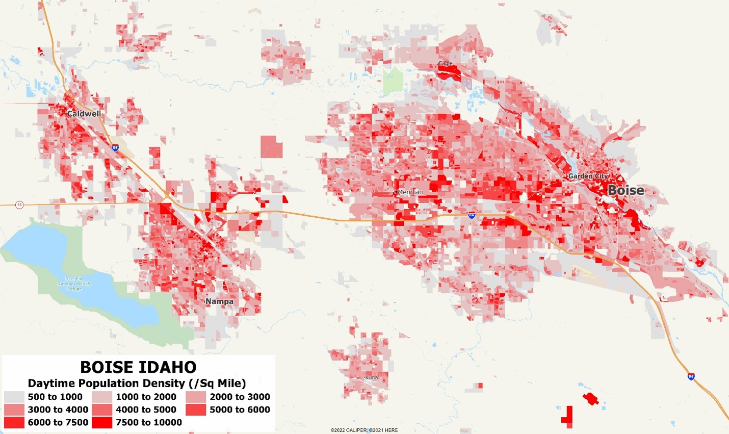
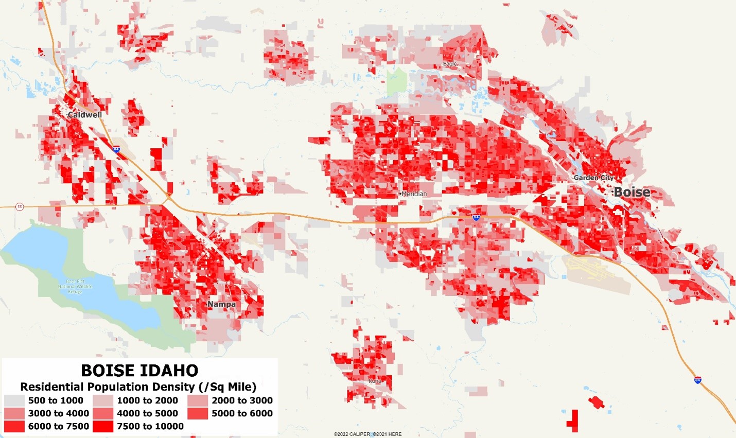
But the block level exposes small area details that may be important – distinct shifts from one street to the next in demographics, consumer spending, and certainly crime. We put together three maps to show how important the distinctions can be – the first two are metropolitan scale covering Boise, Idaho – with residential population density and daytime/business density. The two maps show some interesting details on where people are in the daytime, where trade areas tend to be tighter than nighttime:
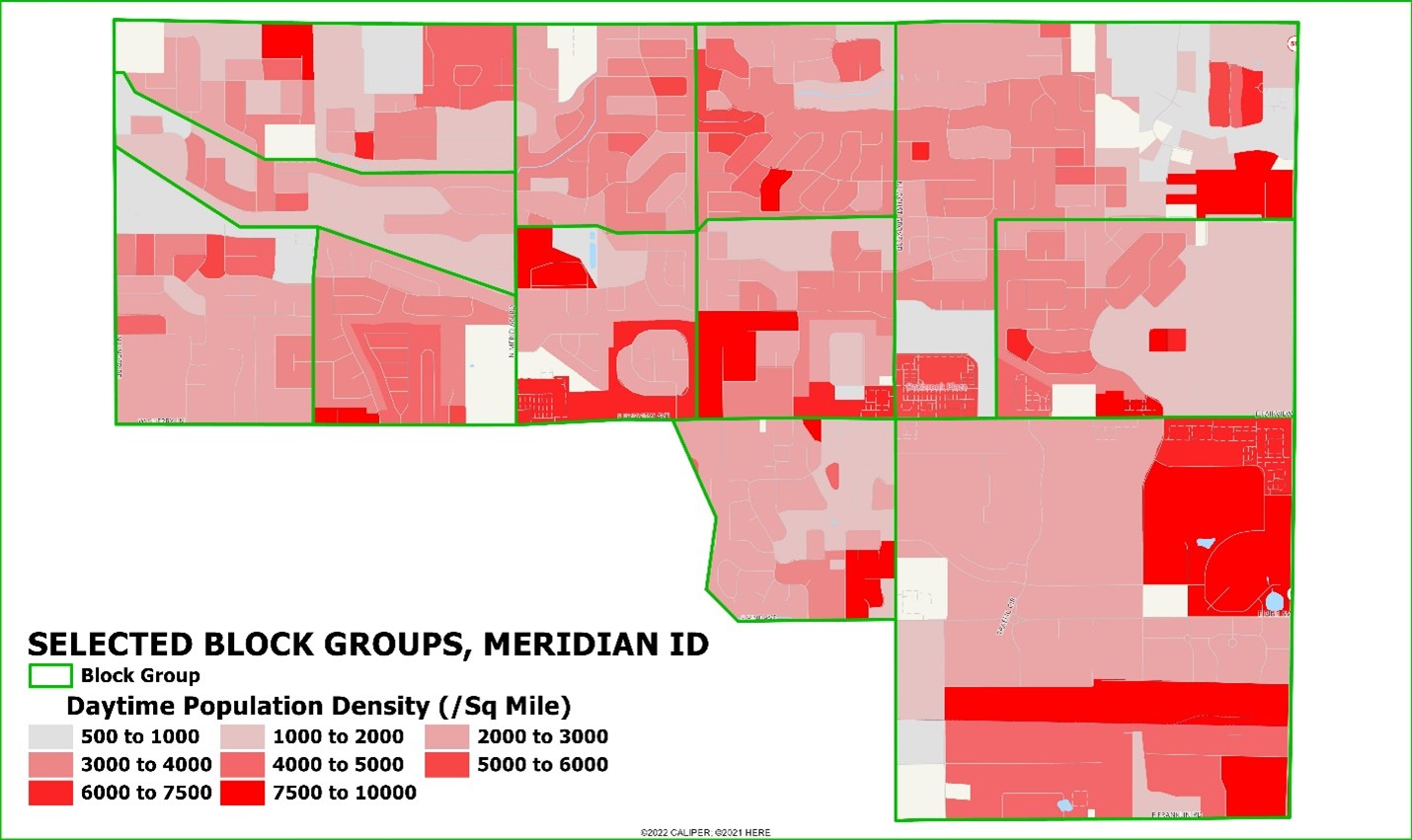
If we look at an area in detail, as below for a set of block groups in Meridian, the richness of the block data becomes apparent:
Block level data can be used to fine-tune location analytics for retail/restaurant locations, market share analysis, transit planning, and electric vehicle charging stations. Likewise, for commercial insurance underwriting, micro-patterns of crime risk will reveal risks which arise with specific land uses such as motor vehicle theft from parking structures.
For detailed analysis, the 2023A release includes several levels of detailed data:
- Block group, on one of several different base rosters from 2010 based to the new 2022 block groups with the changed codes for Connecticut
- Our two grid geography levels – normal (1 mile grid, approximately 800,000 areas nationwide) and detailed (1/2 mile grid, approximately 1,900,000 areas) – which offer map views a consistent size and shape geography
- Block level data, which can be filtered to include only populated blocks, blocks with businesses, or all blocks.

Recent Comments