
Between the county and block group levels – one too general, the other often too detailed. For many analytical tasks, an in-between layer is just what the doctor ordered. So, is there a goldilocks solution?
There are four primary choices of standard geographies between these two levels of detail:
- ZIP Codes (ZI)
- Census Tracts (TR)
- Places (PL)
- County Subdivisions (CS)
ZIP Codes are most often used, despite some serious and well known limitations, while Tracts are rarely used, despite the benefit of stability over time. The other two layers are often poorly understood by users and thus ignored.
The PL Layer should be used when it is important to match municipal government boundaries. Visually, however, they can be extremely complex. Below is the boundary of Weatherford, Texas:
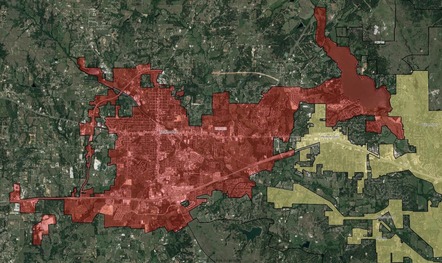
Weatherford Place Map
Note the creative annexation of parcels along the loop highway west of the town, along I-20, and the unincorporated bits which most would think were within city limits. This is the rule rather than the exception. Eldredge Gerry, whose rather adventurous redistricting of Massachusetts two centuries ago gave rise to the term ‘gerrymander’, would be most proud.
The key characteristics of each layer – and some use guidelines — are in the table below:
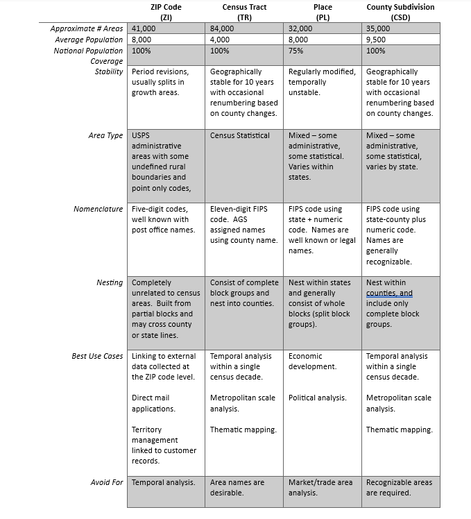
The often-overlooked county subdivision geography merits consideration for regional analysis. Defined for statistical purposes, they are roughly the size of ZIP codes but are composed of whole block groups and fit nicely into county boundaries – thus avoiding the aggregation and change issues presented by ZIP codes. At the end of the day though, for most regional or metropolitan scale analysis, our preference for thematic mapping is a grid layer which offers both consistency and stability over time.

The chart above is handy! Thanks for putting it together.
One practical benefit of zips is that they are easy to talk about internally as most folks have a mental model of what a zip is. It’s more challenging to discuss tracts, places & county subs without a map of those geographies.