Our sister company, Applied Spatial Technologies, is releasing an updated version of its flagship Freeway drivetime system. Freeway was first released in 1996, and since its major facelift in 2019 has continued to add capabilities and substantially improved performance.
Version 2.1 introduces two major capabilities:
- Point-to-point drivetime computations for one or more origins and destinations. A common application is to compute drivetimes between a store and its competitors, or to create origin-destination timetables.
- The ability to specify multiple origin locations and create a single polygon for each drivetime specified that encloses all territory reachable from any of the sites. While this could easily be done within a GIS environment, Freeway does so in a highly efficient manner.
In addition, Freeway now includes a mid-level of detail which results in detailed polygons but with substantial performance improvements
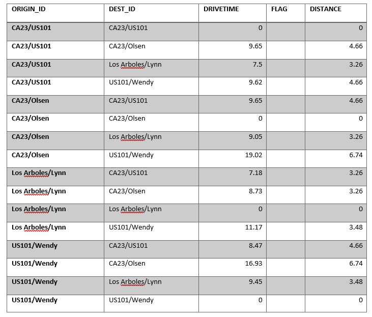
As a test, we took four points in Thousand Oaks, California and computed a drivetime table:
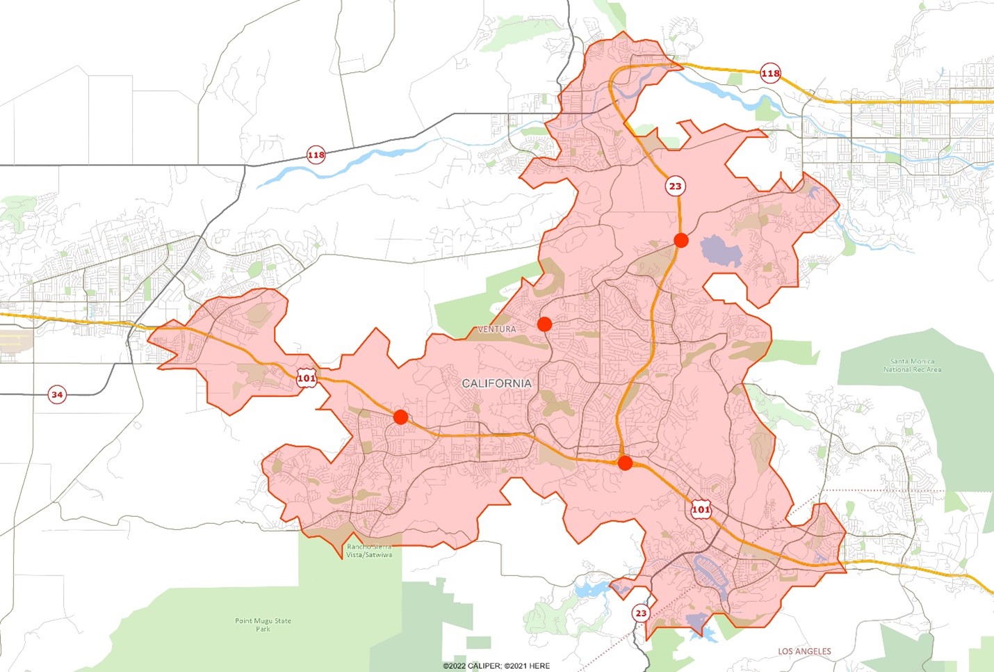
A coverage polygon for the four sites using an 8 minute drive time is shown on the map below:
Freeway is available in a wide range of forms from traditional desktop to API services and is widely used as the drive time engine of choice in site location applications.