
Fun fact — Windsor, Ontario, just across the river from Detroit, is at the same latitude as Sacramento, California.
The vast majority of the Canadian population lives within a couple of hundred miles of the American border. At first glance, this seems like a mild case of regret at not joining the revolution. We can boil the cause of this down to a few nuisances: climate and geography.
Of the 38 million people, nearly half live in just two metropolitan areas – Toronto and Montreal – which are both among the largest cities in North America. Southern Ontario and much of southwestern Quebec looks very much like Michigan or Ohio. Move away from this core population area, and there are really only a few significant concentrations of population – or for that matter – settled areas –
- The lower Fraser valley and coastal Vancouver Island
- Coastal areas of the Atlantic provinces
- Resource based towns such as Sudbury Ontario, Kitimat BC, and Labrador City NL and small towns along the routes that connect them together.
At the time of the American Revolution, the thirteen colonies had an estimated 2.4 million people, and the northern colonies no more than a couple of hundred thousand. The general ratio between the United States and Canada has persisted ever since.
In the United States, the great barrier to the westward expansion were the Appalachian Mountains. To the north, the mountains are replaced by a geologic formation known as the Canadian Shield, the weathered and rugged granite remains of a mountainous area that covers much of eastern Canada.
The landscape and settlement patterns of southwestern Ontario very much mirror those of Michigan and Ohio. But, this settled area abruptly ends northeast of Toronto along a line roughly following the Trans-Canada Highway.
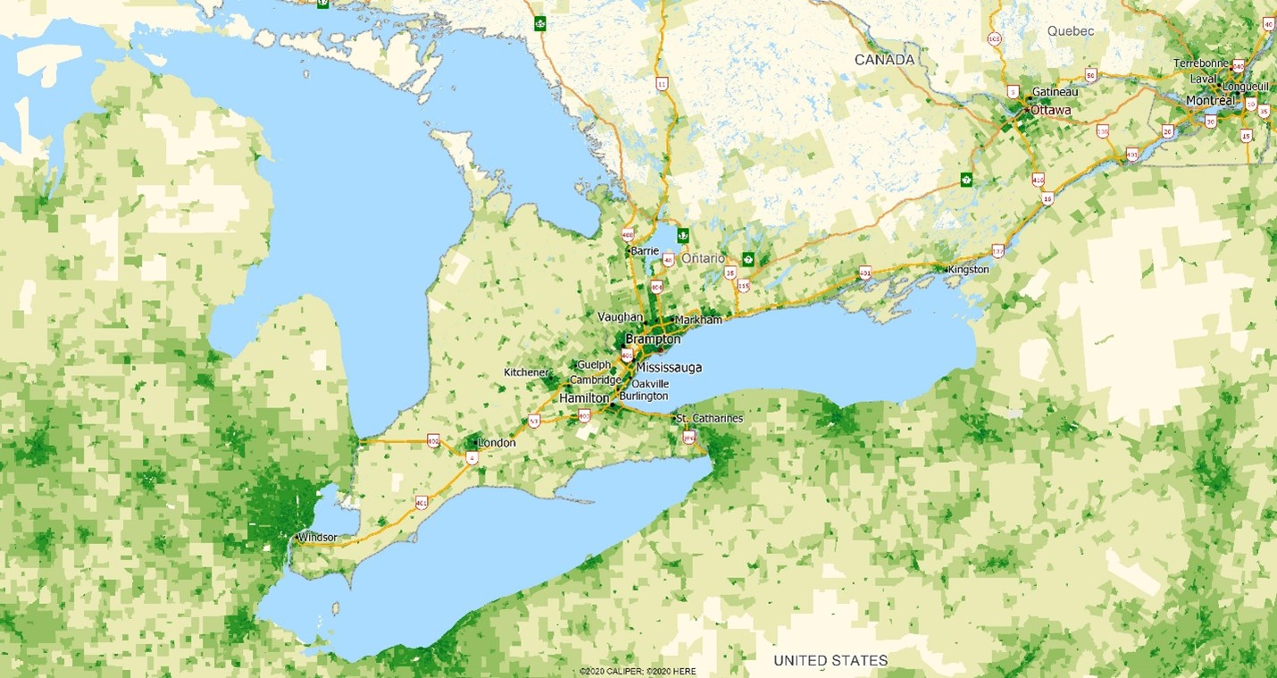
The highway marks the demarcation of the Canadian Shield, which is dotted with lakes and, while the home of many weekend residents, is unsuitable for agriculture and was never well settled. Further east, along the St. Lawrence and Ottawa Rivers, expansion is limited by the Canadian Shield to the north and the Appalachian Mountains on the south.
In the east, the Atlantic provinces have always been hampered by their relative isolation on the continent and, as importantly, the rugged landscape – in the same way it has affected Maine, and most development has been along the coast at strategic ports like Halifax, Saint John, and St. John’s.
To the west, settlement of the vast northern plains occurred at roughly the same time, and even pace, of the northern states of the Dakotas and Montana. The triangle anchored by Calgary, Edmonton, and Winnipeg marks the extent of continuous settlement – bounded on the west by the mountains, the east by the granite shield, and the north by climate. The growth of its main cities has been largely based on the oil fields of Alberta and Saskatchewan and the collection and shipping of wheat.
British Columbia has developed in very similar ways to the Pacific northwest states of Washington and Oregon – through the development of key coastal ports, resource towns, and the occasional agricultural valley.
From a continental perspective, the density map of Canada looks like a continuation of the United States that abruptly terminates. Much is due to climate, but more is due to landscape.

Some great tidbits in this less technical post! Ours certainly is a continent heavily influenced by landscape as one looks across the 49th parallel and beyond. The Edmonton-Winnipeg corridor referenced here is perhaps the most striking settlement boundary for me to keep in mind, and I think it’s fair to say it extends in similar direction towards Michigan in spots not so far north of Windsor. However, it does muddy the argument to lead with the erroneous Windsor comparison! The whole of California does lie south of Windsor, with the northern border matching that of Pennsylvania to the east. Otherwise, interesting points!