
In recent years, the Nashville metropolitan area has been one of the ‘hot’ markets nationwide, as evidenced by the count of construction cranes in the downtown core. While much of this growth has been an expansion of the urban footprint, in recent years attention has been turned to redevelopment of some of the industrial areas near downtown.
New development can be tracked by carefully watching urban fringe areas for signs of impending change – corporate purchases of large properties, parcel subdivision, postal changes, and infrastructure development. In Nashville, the pattern of freeway development has had a major effect on the shape and direction of suburban growth:
But during this time, the density of development within the older parts of the city has increased, especially in the downtown core. Much of the area around lower Broadway Street has been redeveloped into a mix of hotels, large office buildings, and large apartment complexes. The ‘Gulch’ has been transformed over the last decade from being an old industrial area to a high density hip residential zone.
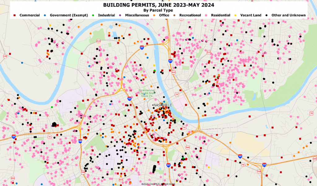
There are two primary components at work here – redevelopment of older commercial and industrial areas as residential zones, and infill development in existing residential zones. To track this effectively, without waiting for the next decennial census, we rely upon tracking at the individual parcel level. Combining changes at the parcel level (ownership, size and shape, land use, building footprint) with additional sources is key. To keep up with local changes, we are using the recently available national permit database from shovels.ai, and this allows us to capture infill developments that are otherwise often missed – the building of ADU’s on existing properties, the conversion of commercial and industrial space to residential units, and infill on parcels which were simply never developed in the first place. The map below shows the distribution and type of building permits issued for the latest two year period ending June of 2025:
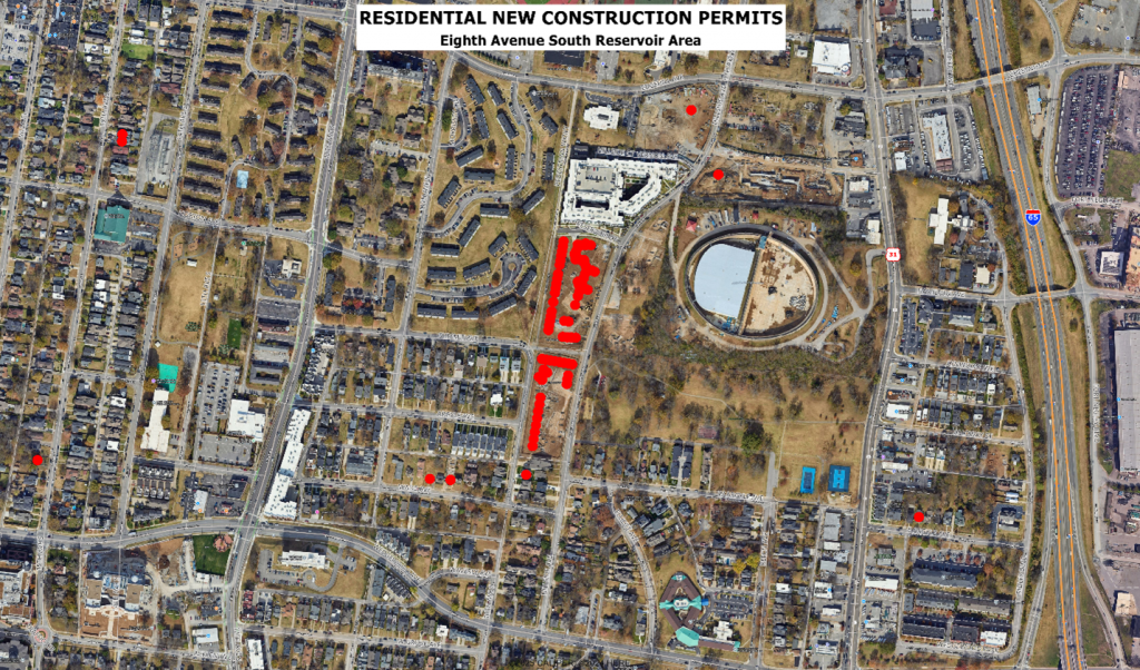
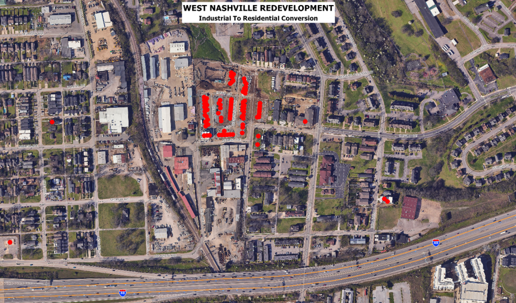
Two of the more interesting developments that we are tracking are shown below – both of which are in areas of the city which have long been developed.
Capturing these infill developments in a timely manner with traditional sources is simply not happening. The evolving methodology at AGS goes well beyond counting zip+4 points by focusing on zoning, parcel change, parcel owner1ship, and monthly building permits.

Recent Comments