As part of our ongoing project to revolutionize the accuracy of small area demographic estimates, AGS has been busy constructing a national parcel level file as one of the cornerstones of our focus that identifies new addresses as they are created, developed, and occupied. This, combined with our other efforts, will transform the way that demographic data is created.
Tracking changes in the parcel fabric is a daunting task, requiring the comparison of nearly 150 million parcels nationwide from one quarter to the next. In most census blocks nationwide, we find very little change from one quarter to the next, especially if we eliminate noise that occurs simply because of minor changes to property boundaries.
The map below shows census blocks in Las Vegas where significant parcel change activity is occurring – in most cases the subdivision of an existing large parcel into many smaller ones, and excluding the streets which may not even yet exist:
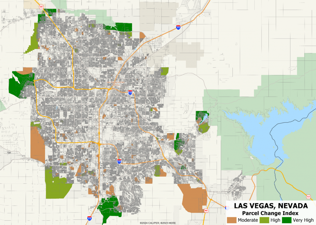
As one might expect, the parcel change technique identifies eight main hotspots where growth can be expected. It also identifies many areas which are already largely developed where additional infill is occurring. On the east side of the city is the Lake Las Vegas development:
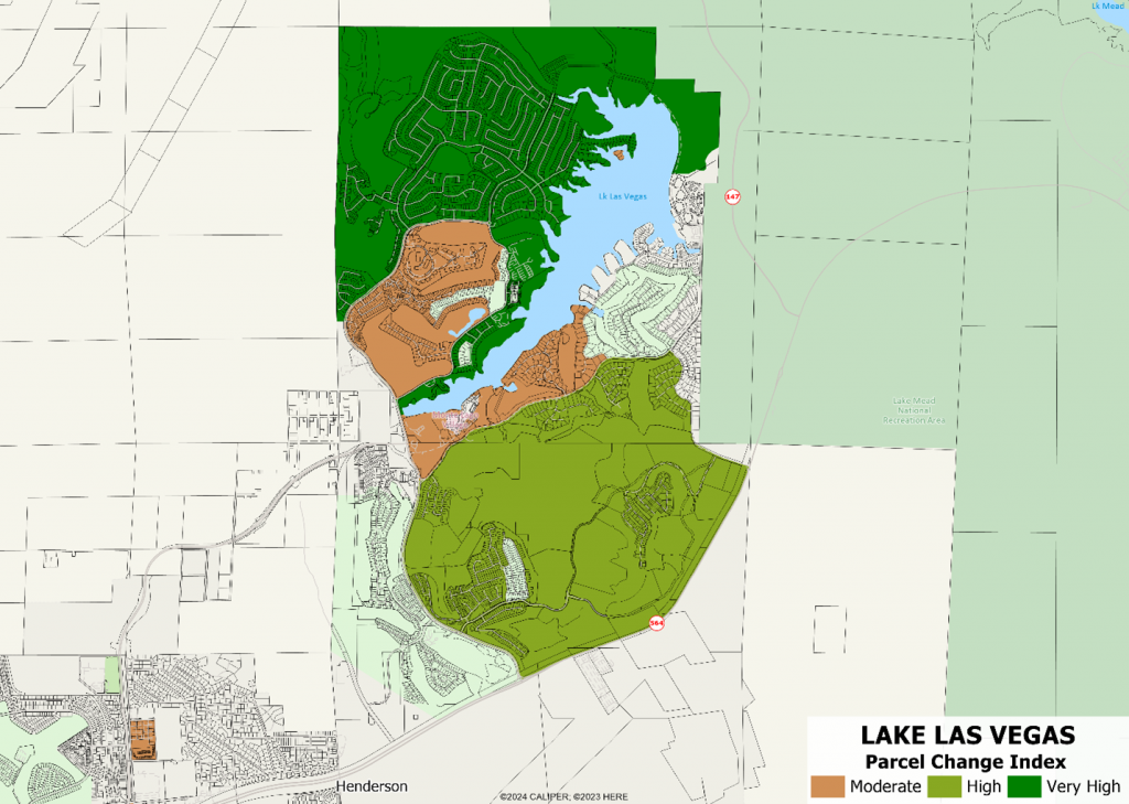
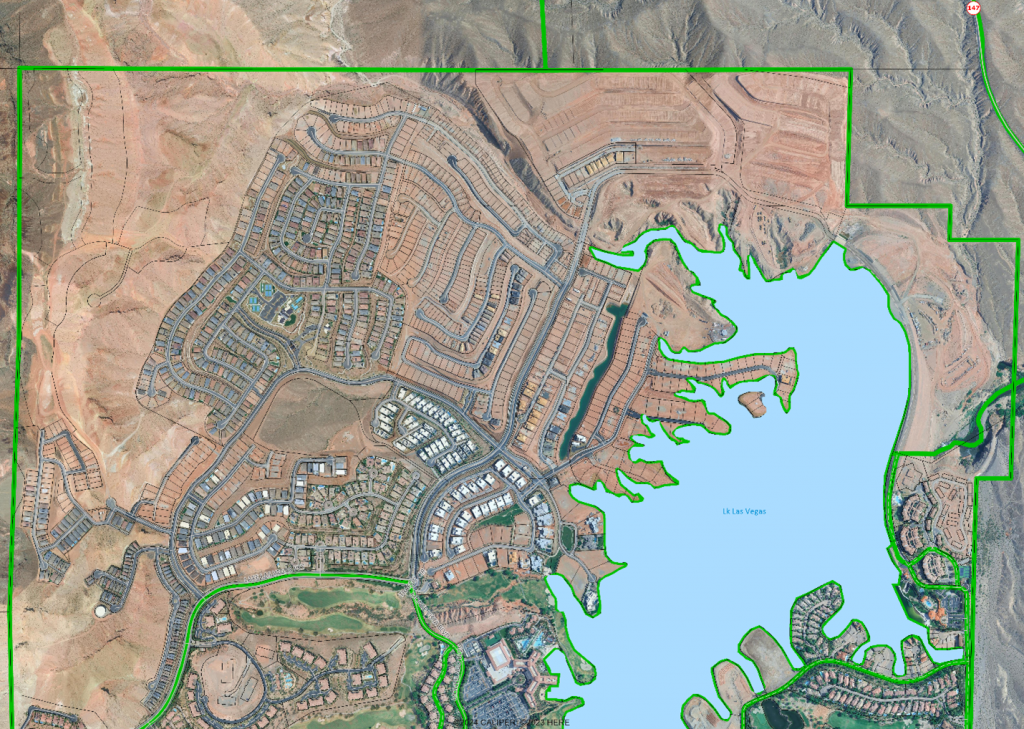
Here we see that there are several blocks already developed, but the northernmost block had hundreds of new parcels created just in one three month period. Satellite imagery clearly shows that the development is occurring in stages – with a significant number of houses already completed, some areas being developed, and some areas being prepared for streets and underground utilities:
Parcel change is but one part of our multi-source approach to tracking new development that includes:
- Identifying newly added streets and street segments in open source street maps, both named and unnamed
- Comparing building footprint files to identify new and/or substantially modified buildings and matching these to new and existing addresses and ZIP+4 codes
- Block level summaries of total addresses by units in structure, providing essential information on infill and redevelopment projects
- Compiling and maintaining a list of new home development projects, especially those which involve multiple builders
As these components are fully implemented, the results will be a census block level change tracker that identifies precisely most of the new development nationwide. Satellite image analysis can then be used to track these developments to completion.