You might think that the biggest factor in your commute is the number of people on the road. In fact, geography is often the biggest limiting factor in shortening the time you spend in your car, or sometimes, a way for you to make your commute faster. We look at various metropolitan areas and look at interesting drive times, which makes us wonder, should drive times impact your trade area analysis?
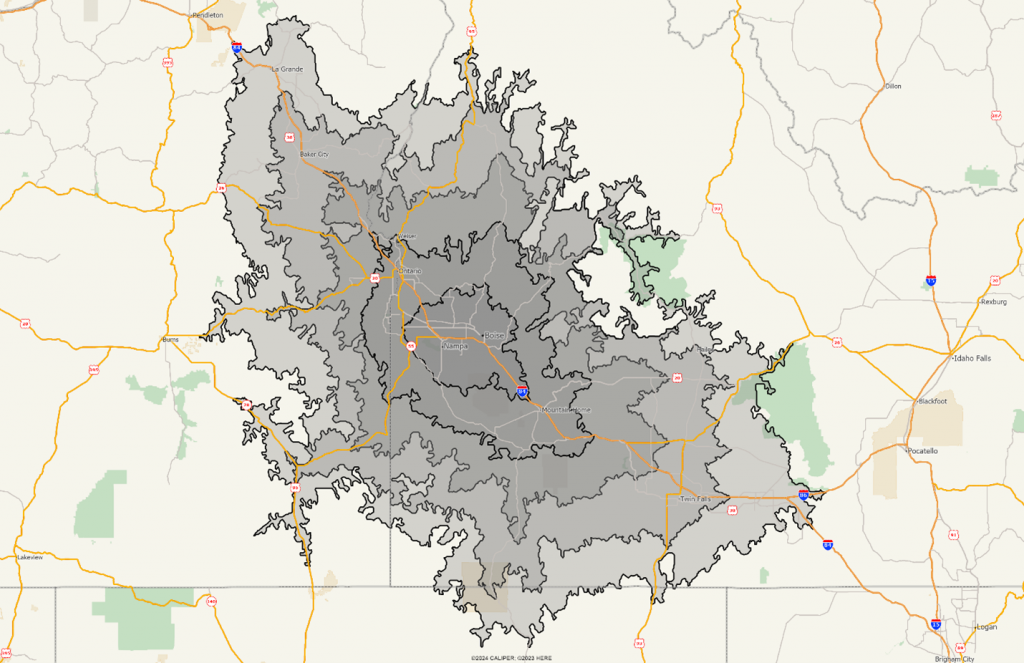
First up is Boise, ID, showing one-hour increments of drive times (60, 120, 180, and 240 minutes) using a moderate level of detail. It is clear that the map starts to curve around the Northeast of the map, as the mountain range is the limiting factor in drive times.
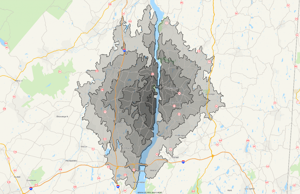
Next is a map of Milton, NY, where the Hudson River becomes a limiting factor. The map below shows 1, 3, 5, 7, and 10 minute drive times from Route 9W across the river from Poughkeepsie, NY. The key here is that the bridge crossings mean that areas directly across the river (a few hundred feet) are actually 7–8-minute drive times. Any radius-based trade area is going to likely overestimate the population.
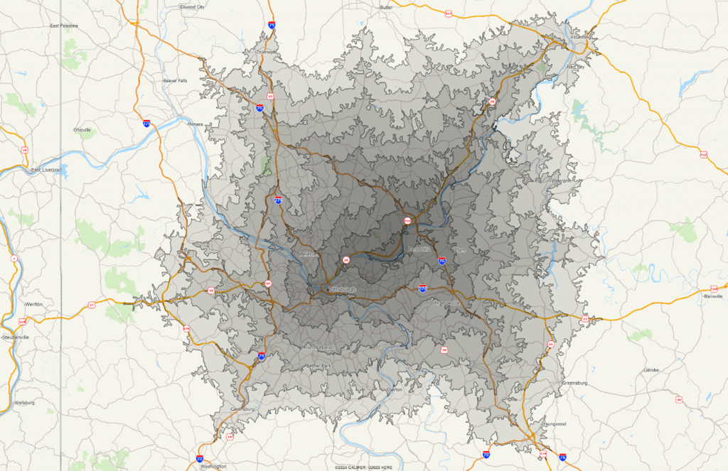
Below is a very cool map showing 5 minute drive time bands from a point just east of downtown Pittsburgh. Note the elongation along the interstate system, as in this case, the highway system allows for faster drive times. The drive times are overlapped using a semi-transparent shading to give the shading effect:
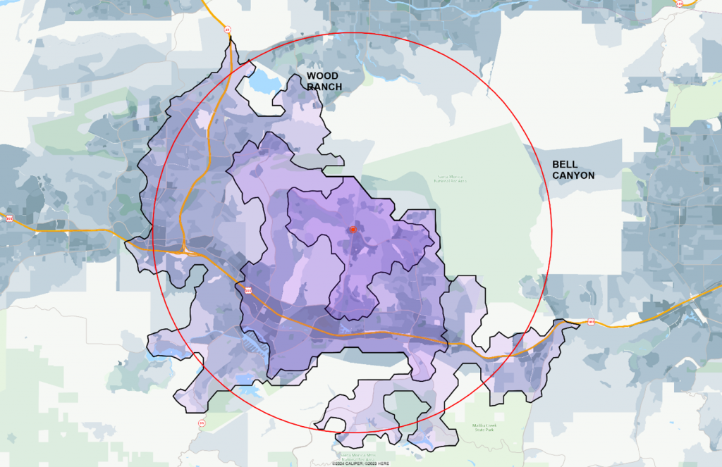
Finally, a map of Thousand Oaks (AGS HQ) – centered on a shopping center with several popular restaurants. The radius is 5 miles, and the drive times are 5, 10, and 15 minutes. The thematic underlay is at the block level showing daytime population. This map really shows how different the drive time trade area can be from a radius one – it also highlights the errors in a radius trade area that includes portions of Wood Ranch and even parts of Bell Canyon. The Bell Canyon inclusion is particularly erroneous because it is at least another 15 minutes of drive time, and certainly not part of the actual trade area.
If you are interested in Freeway, it contains a large range of features that make our system unique. Freeway includes:
- Six separate road classifications, with the ability to use only arterial roads and freeways to build the drive time polygons
- Traffic settings – normal, moderate, and heavy – for drive times, or you can use drive distance
- Global coverage – even Antarctica!
- Origin-destination tables where you can create drive time or drive distance tables between a set of origin locations and a set of destination locations
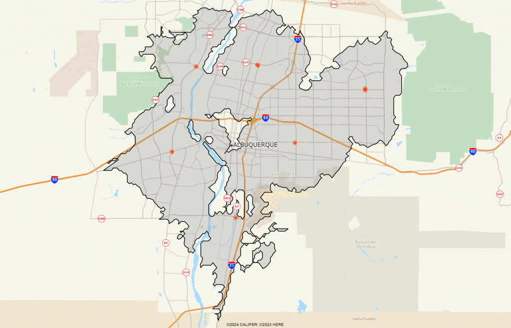
- Coverage polygons – imagine taking the set of site locations in a metro area and creating a single polygon representing the total area within a five-minute drive time area. See the map below of Albuquerque as an example.
