
Demographic and consumer data is often just one of a wide range of data elements which must be brought together to undertake a modern location analysis. And while the toolkits for managing and analyzing the data are increasingly available – often at minimal cost – many companies are opting to minimize their costs and development effort by tapping into subscription-based API’s.
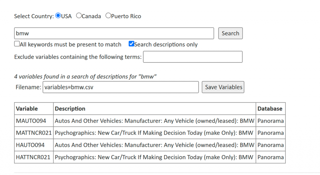
The AGS Snapshot API provides a growing range of services oriented towards the on-demand delivery of reports and data. The key to those services is the report template. Access to the AGS library of data – with 55,000 elements in the United States and 3,000 in Canada – is admittedly difficult to navigate. How on earth do you find out what information we have on where demand for frozen peas is highest without having to read pages and pages of variables? Our variable search utility allows for keyword searches so you can find variables which include “BMW”:
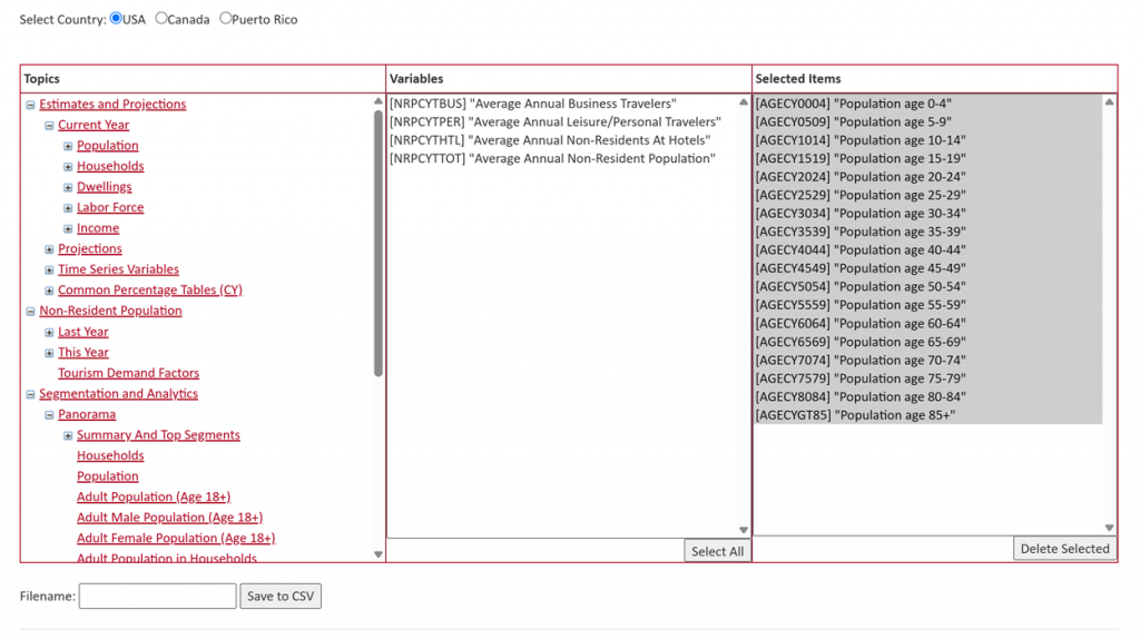
Report templates consist of pre-existing variables, computed variables, and when reports are built, formatting and layout options. Over fifty different functions are supported, including the spatial statistics and regression estimates. Templates can be built on our website or using our desktop report designer that includes several report layouts and considerable design flexibility.
Snapshot has about twenty pre-defined reports covering a wide range of topics from demographics to environmental conditions and crime risk. New reports can be designed by users, or by AGS in a matter of a few hours in most cases.
The main features of the API?
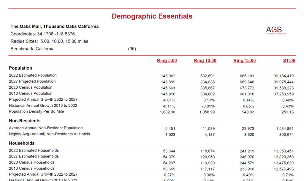
Location reports, including radius, drivetime, and geographic areas such as ZIP codes or counties. These reports can be formatted as PDF files or delivered as a csv or Json data stream.
- Ranking and comparison reports, which return a table of attributes as rows and geographic areas as columns. The geographic areas can be a mixture of different objects, such as radius and drivetime areas and geographic areas at different scales (e.g. county, state, and national columns).
- Thematic mapping support, where the data for a target geography and a display window is retrieved on demand
- Drivetime polygon generation, using the AGS Freeway system, with global support.
- Bulk location operations, allowing users to upload a location data file (say your store locations) and return a file containing trade area data for each. The most common usage is to return CrimeRisk scores for address points, a function which is critical for insurance underwriting.
- Access to the AGS library, which enables end user applications to easily and quickly build a navigational tree to allow users to create and maintain their own templates.
Every month, several hundred demographic reports and thousands of drive time polygons are generated for a growing list of both end users and channel partners. Want to add reports and data to your application? Get started with a trial API key and be delivering demographics within minutes.

Recent Comments