
This being summertime, we thought we would spare you a discussion about optimal kernel size selection for multiscale geographically weighted regression, no matter how cool the AGS geek squad thinks that may be. In its stead, we offer some lighthearted spatial curiosities.
The international border between Canada and the United States has often been touted as the longest undefended international border in the world. It is an astonishing 5,125 miles, much of it passing through sparsely populated areas. Much of the border was drawn up without regard for the local landscape, often by people hundreds or thousands of miles away, that resulted in some delightful oddities.
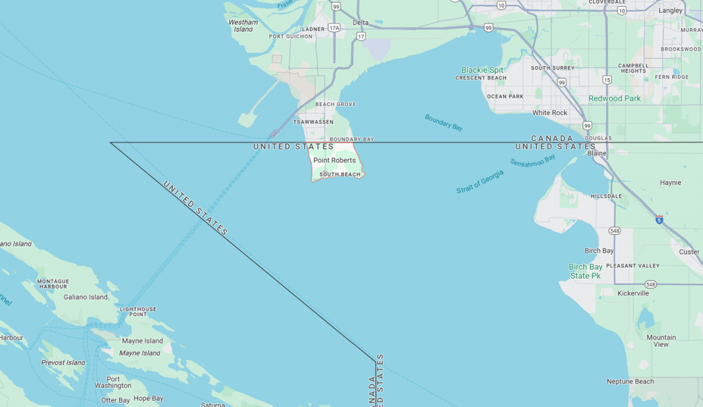
The 49th parallel serves as the border between the Strait of Georgia and Lake of the Woods, but there are oddities at both ends. While there was dispute over several decades, the lines were drawn long before the settlers arrived. Point Roberts, Washington is a small town of about 3,100 people at the southern end of a peninsula separated from the remainder of Whatcom County by two border crossings and twenty-five miles:
At the eastern end, the border is peculiar to say the least.
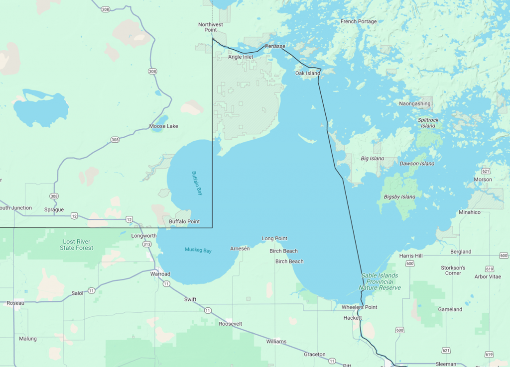
Why the northward jog to include what is known as the ‘Northwest Angle’, populated by about 150 hardy souls? The Treaty of Oregon, 1846, provided that the boundary would proceed from the northwest corner of Lake of the Woods along the 49th parallel. The problem? The maps were wrong and rather than reopen the argument, things were just left alone. So, the trip from Angle Inlet to Longworth is nearly 60 miles, with only one border crossing but two ‘Welcome to Manitoba’ signs.
For those interested in terminology, these are known as ‘pene-enclaves’, a term coined by the geographer Arthur Robinson in 1959. Surveying errors along the border of as much as 700 meters mean that what we think is a straight line really isn’t.
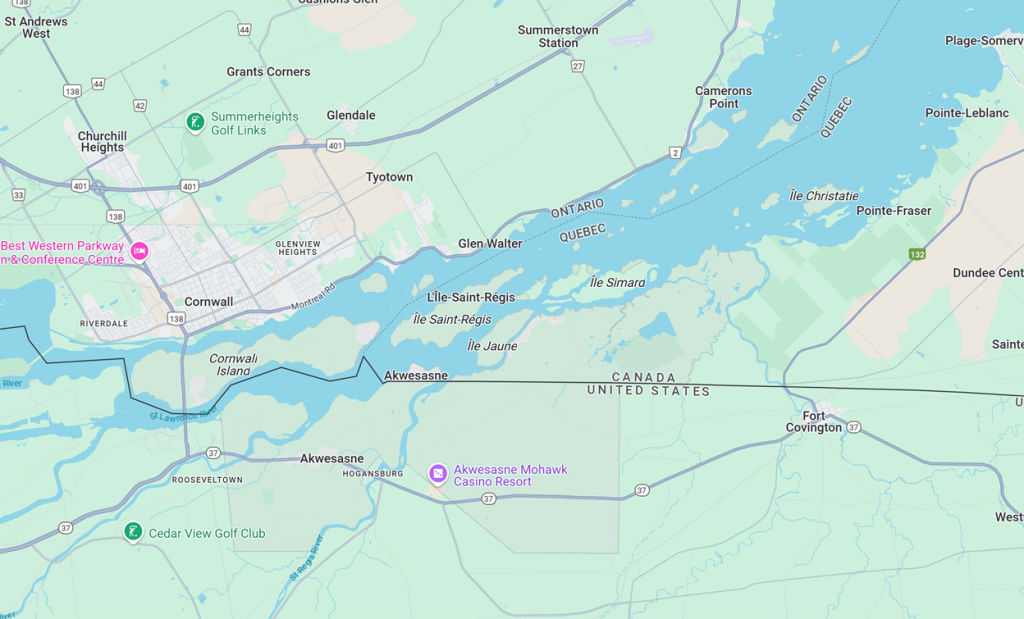
In the east, the border was set at the 45th parallel for much of the boundary between Quebec and New York. In this case, the arbitrary line results in a pene-enclave of Quebec which is part of the Akwesasne native reserve.
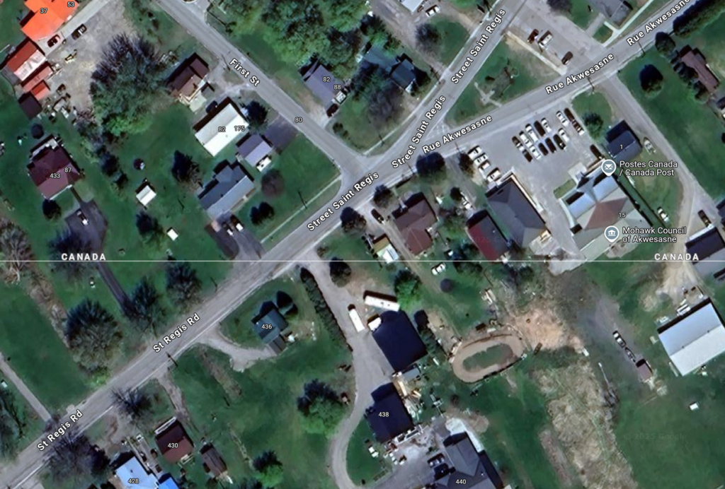
The border is irrelevant here and is not even marked, clearly crossing property lines and even bisecting buildings:
Further east, the village of Beebe Plain is split by the Quebec-Vermont border which runs straight down the middle of Canusa Road and runs straight through a building that predates the border definition and served as the post office for both sides of the border for many years.
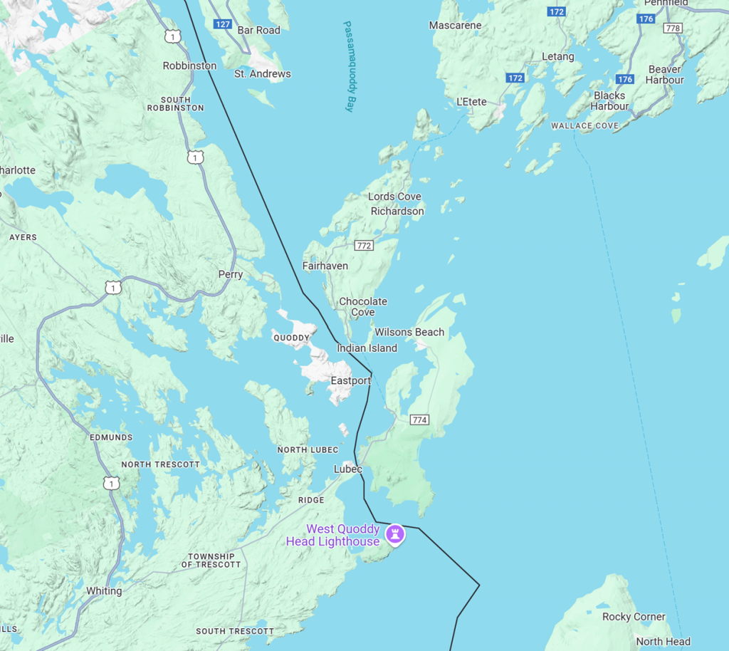
Likewise, the northern and eastern border of Maine was long disputed, largely because of what turned out to be ambiguous language in the 1783 Treaty of Paris which officially ended the American war of independence. While the northern border dispute was finally settled, there remains one tiny, disputed island: Machias Seal Island, which is occupied by the Canadian Coast Guard but claimed by the United States, denoted by the small circle lower center:
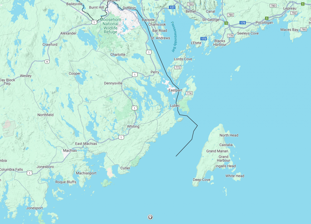
Finally, and perhaps more interesting than who owns a lighthouse, is Campobello Island, New Brunswick, where a bridge to the mainland at Lebec, Maine allows its residents to avoid two seasonal ferry rides – first to Deer Island and then to L’Etete on the mainland. The bridge was financed by a Canadian act of Parliament and completed in 1962. The bridge was named after Franklin D Roosevelt, who owned a summer retreat on the island.

Recent Comments