Last week, a series of devastating fires broke out in the Los Angeles area when unusually strong late-season Santa Ana winds combined with plentiful dry fuel to create the ideal conditions for disaster.
Santa Ana winds are most common during the late fall but can occur anytime there is an inland high pressure cell and an offshore low pressure cell. The greater the pressure differential, the stronger the winds as they get funneled through the passes of the transverse range (I-5, I-10, I-15) and intensified along the coastal canyons. Worse, these winds are usually hot and dry, reducing relative humidity to extremely low levels.
Two recent wet winters have created lots of brush to serve as fuel, and rainfall this season to date has been almost negligible. This is the typical pattern – a wet year or two followed by several years of drought.
Combine a particularly strong Santa Ana with near hurricane force gusts in the windier canyons with dry and plentiful fuel, and you have the perfect conditions for wildfires that effectively create their own microclimates.
Over the past decade, budgets in California have been increasingly diverted to fund services for the homeless and other programs. In the city of Los Angeles, the LAFD share of budget has declined from 7.3% (2010-11) to 6.4% (2024-25). There is no doubt that underfunding at all levels has diminished the ability to effectively wage war on multiple fire fronts.
At the same time, the population has continued to grow, and development has progressed into more and more high risk areas.
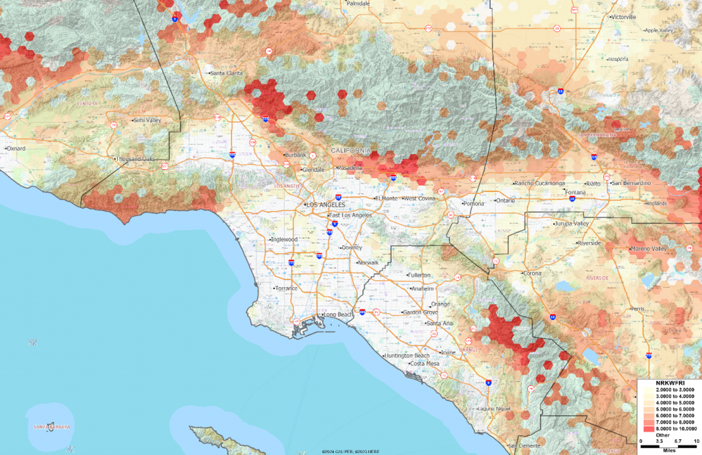
The map below shows the AGS wildfire risk score, mapped using H3 hexagons, overlaid on a Google terrain map:

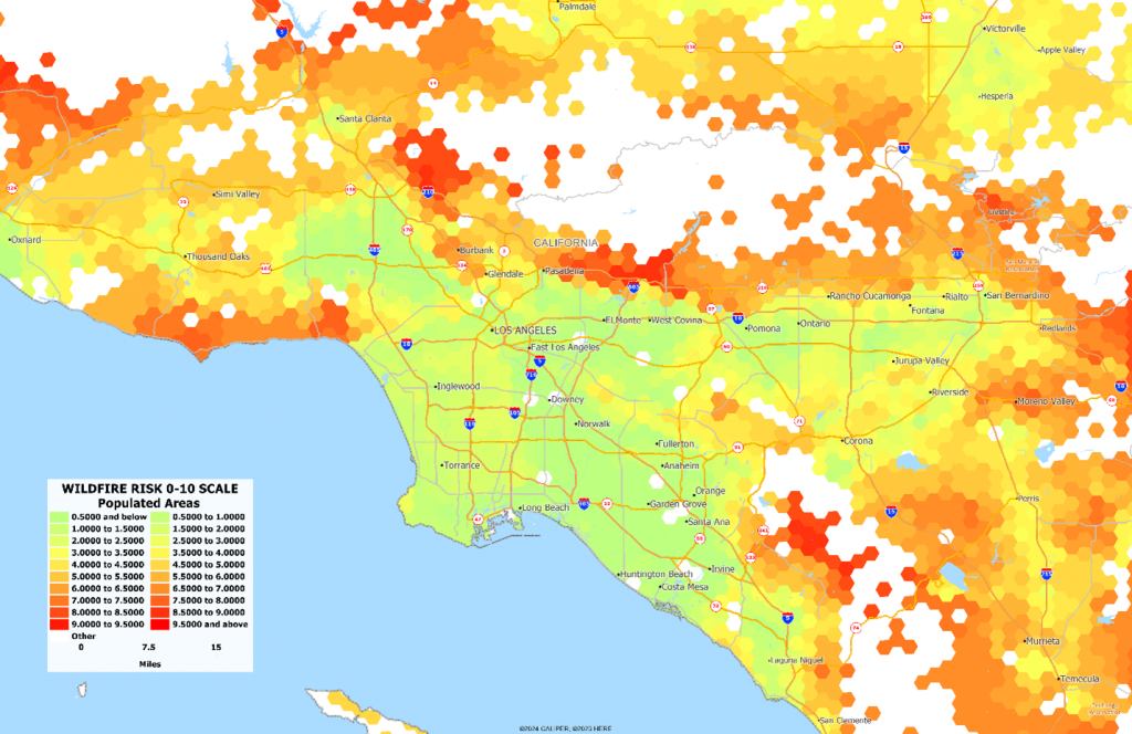
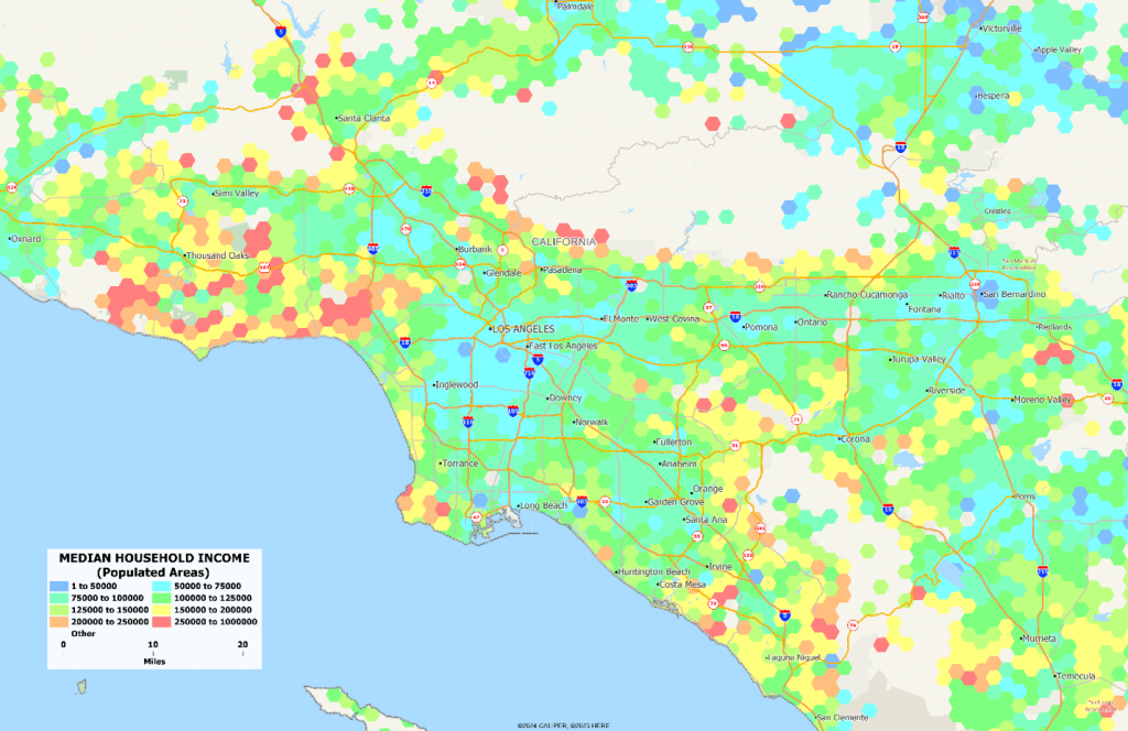
Three of the major risk areas are along the coast from Malibu to Santa Monica, along the I-210 Foothill Freeway from Sylmar though Pasadena to Rancho Cucamunga, and a third in eastern Orange County to the south. Without the terrain, the two maps below show clearly that these high risk areas are also among the wealthiest communities in Los Angeles:


Damage from these fires is primarily in two areas – Pacific Palisades and Altadena – and entire neighborhoods have been destroyed. Despite promises of removing red tape and assisting in rebuilding, the byzantine maze of bureaucracy will undoubtedly make this a long and arduous process.
AGS is committed to tracking rebuilding efforts after natural disasters and, using our parcel level base data and time series analysis of satellite imagery, will be able to report on progress towards reconstruction at the census block level. Over the coming weeks, we will explore these disaster areas in detail, and begin to track their redevelopment.
