Toronto is generally considered to be one of the most cosmopolitan cities in the world, even more so than New York or Los Angeles. Of the nearly 7 million residents, almost 45% are immigrants who have arrived from many nations across the world.
Hidden below that statistic, however, are strong geographic patterns of group segregation. Many of these immigrants tend to cluster with immigrants from the same country, or at least the same part of the world.
Mapping the largest immigrant origin or even ancestry by dissemination area tends to result in a lack of clarity when shown on a map. But when we use the Dimensions Canada database, which attempts to capture the most significant neighborhood differentiators, we find several significant countries of origin or ancestry differences:
- The French-English divide, which have both ancestral and linguistic differences.
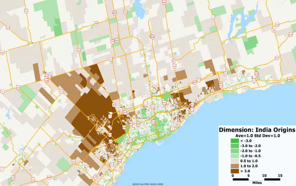
- Indian Subcontinent, which tends to group together immigrants from India, Pakistan, and Sri Lanka. Despite the cultural, religious, and linguistic differences, these immigrant groups tend to cluster together.
- Asian Influence, which tends to represent most of the southeast Asian nationalities except those from China, which is a large and distinct group in its own right.
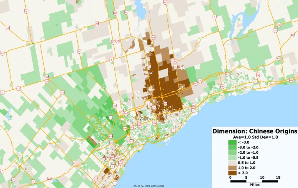
- Chinese influence
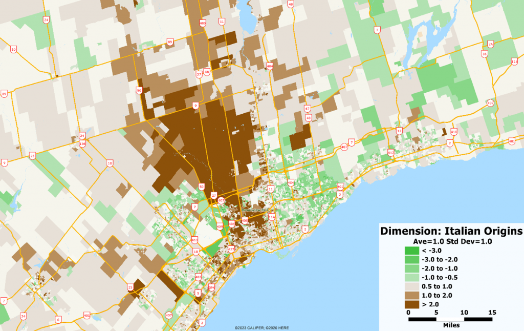
- Italian Ancestry, which despite the lack of recent immigration from Italy, retains its particular spatial pattern, especially in the Toronto region
Within the dimensions scheme, these are differentially weighted according to their contribution to the explanation of neighborhood variance, so while the Italian influence nationwide is relatively low, in Toronto it is a highly significant feature of the city.
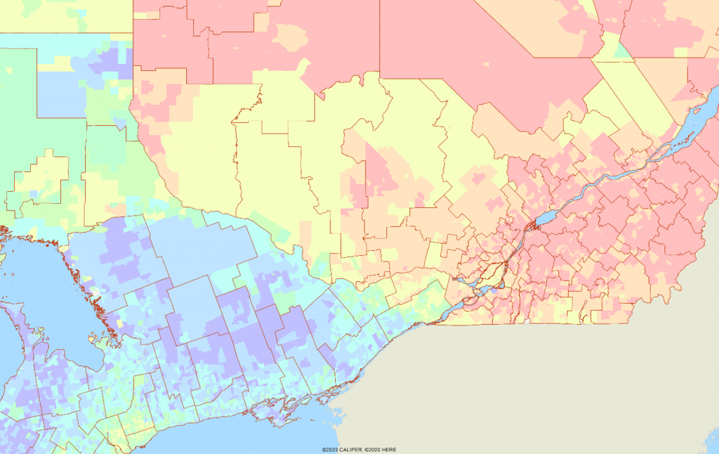
The English-French divide is not particularly important within Toronto, as the map below shows (English in blue, French in red), as the demarcation line roughly parallels the Ontario-Quebec border with exceptions in the north and in areas east of Ottawa.

With Toronto, the major immigrant/ethnicity areas are shown on the maps below:


Together, these three areas of clear ethnic delineation cover much of the northern parts of the city, with the Italian influence in a corridor from the central city towards the northwest.
The cosmopolitan nature of the metropolitan area masks what are clear ethnic clusters. Smaller clusters, not significant on a national scale, exist as many of the smaller immigrant groups have tended to cluster together. The result is a patchwork quilt of ethnicities within the metropolitan area – with the result being that most individual neighborhoods lack ethnic diversity, but overall, the city is one of the most diverse in the world.
For more information on Dimensions Canada and its uses for modeling, missing data estimation, and neighborhood description, give us a call.
