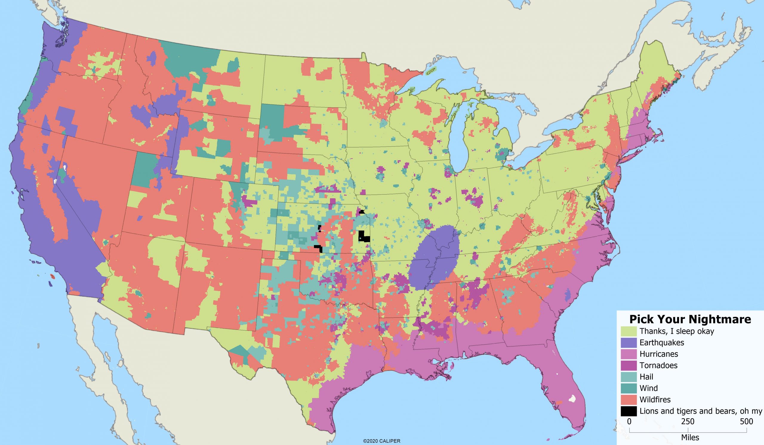
No matter where you live, you are bound to experience some kind of natural disaster, right? Earthquakes, tornadoes, wildfires, hail, hurricanes and high winds are just a part of life, you just get to choose what you are willing to put up with. In the vein of “choose your own adventure”, we looked at what natural disaster is keeping you up at night, based on where you live.
To get the map below, we took the main risks and took out areas which don’t have major risks (maximum index < 150) on any of the categories – these are labeled as “thanks, I sleep okay”. The rest are classified by which of the risks is the highest which makes for a really interesting map. Of course, this means that all risks have been treated as equal, which does make room for some flaws, as there are areas with multiple risks. The result is the following map, which highlights the worst nightmares for home and business owners in any given place.

While most of the northeast comes out unscathed (remember, we did not map snowstorms, so blizzards are out), along with parts of Arizona, New Mexico and Texas (again, we didn’t map extreme heat), the rest of the country has something to worry about.
Unsurprisingly, the entire east coast down to the Gulf of Mexico worries most about hurricanes. The west coast is primarily concerned with earthquakes and wildfires, outside of a pocket in south eastern Washington that avoids natural disasters all together.
For those living in the Midwest, the dreaded storms bring mostly hail and wind, not tornadoes. Spanning the rest of the Midwest, and the southeast is a risk of wildfires primarily.
So, what keeps you up at night?


Elyse: I have nightmares about Woburn Collegiate Institute in Scarborough, Ontario, Canada. Ask your parents about it. Seriously, you could incorporate crime stats into your map. And explain what “Lions and tigers and bears, oh my” means. Heavy concentrations of tornado activity?