In the summer of 1996, a movie about storm researchers became a hit movie: Twister. It followed a group of storm chasing meteorologists in central Oklahoma as they dodged, sometimes unsuccessfully, a line of storms in a single day. The production crew went as far as chasing tornadoes with researchers from the National Severe Storms Laboratory in Norman, Oklahoma, to fully understand what storm chasing entailed and train the crew on weather safety. This year, the stand-alone sequel, Twisters, is poised to be the movie of the summer. What do we know about tornadoes geographically, and why should tornado risk be taken into consideration for site selection or insurance underwriting?
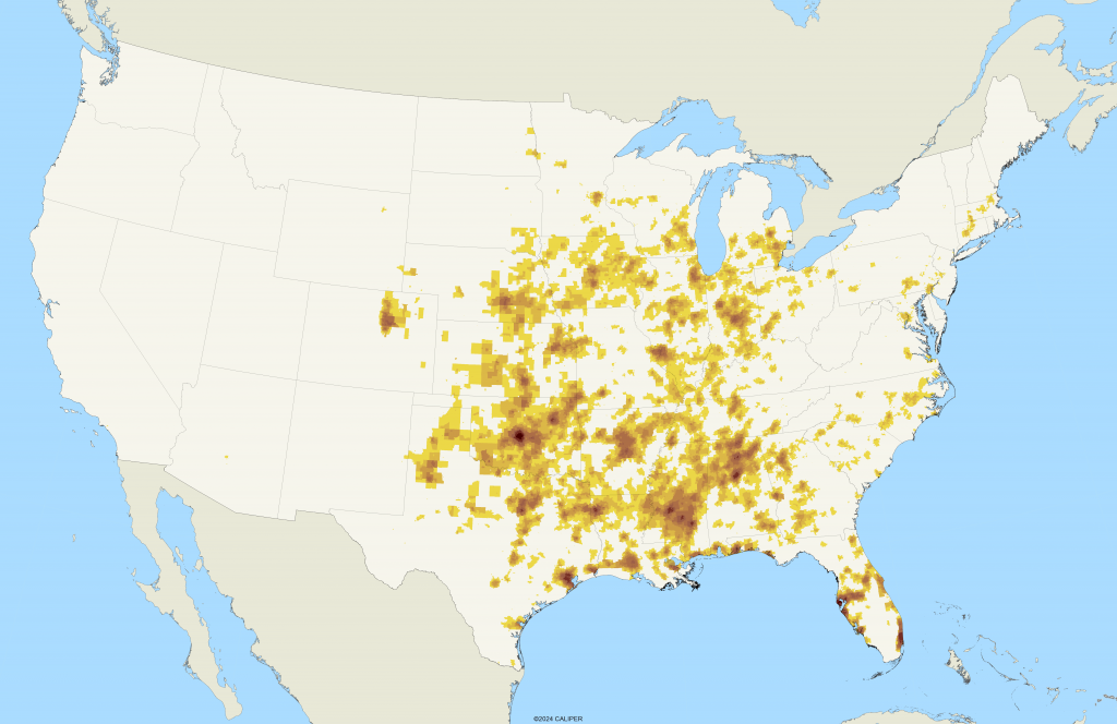
Tornadoes, though relatively rare globally, are a formidable natural hazard, with the United States experiencing the highest frequency of these violent storms. The central United States, often referred to as “Tornado Alley,” stretches from Texas through Oklahoma, Kansas, and Nebraska, up into South Dakota. This region’s unique geography and meteorological conditions—characterized by flat terrain, warm, moist air from the Gulf of Mexico, and cold, dry air from the Rocky Mountains—create an ideal breeding ground for severe thunderstorms capable of producing tornadoes. These conditions are not only conducive to tornado formation but also increase the intensity and frequency of these storms, making the area particularly vulnerable. A national map showing tornado risk is below.
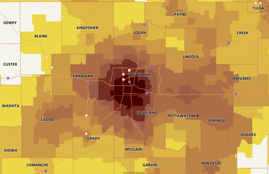
The 1996 movie, centered on the area from Norman to just south of the Kansas border, is no stranger to tornadoes. In fact, Norman is home to the National Weather Service Storm Prediction Center, and the National Weather Center at the University of Oklahoma. Just south of Oklahoma City, this area sees a significant number of severe storms each year.
Understanding the geographical patterns of tornadoes is crucial for various practical applications, including site selection for new developments and the underwriting of insurance policies. For instance, areas within Tornado Alley are at a significantly higher risk for tornadoes, and this risk is factored into building codes and construction standards. Homes and businesses in these regions are often designed to withstand higher wind speeds, and insurance premiums are adjusted to reflect the increased risk.
Beyond Tornado Alley, other regions, such as the Southeast and parts of the Midwest, also experience tornado outbreaks, albeit with less frequency. Because of this, the scope of tornado risk assessment is expanding, prompting insurers and developers to consider broader geographical data and long-term climate projections in their planning processes.
While we will certainly be going to the movies this summer to watch Twisters, it is important to remember that integrating environmental geographical data into your modeling can reduce potential financial risk and help you better prepare for safety concerns for your employees.